Area Overview for EX9 7DA
Photos of EX9 7DA
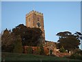
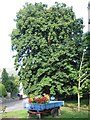
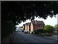
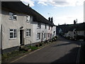
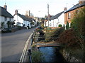
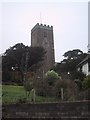
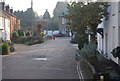

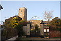
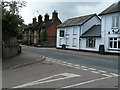
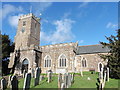
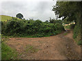
71 photos from this area
Area Information
Key information about the EX9 7DA including its size, population, and administrative classification.
- Area Type
- Postcode
- Area Size
- 26.6 hectares
- Population
- 1544
- Population Density
- 157 people/km²
House Prices in EX9 7DA
15
Properties
£377,333
Average Sold Price
£109,000
Lowest Price
£1,025,000
Highest Price
Showing 15 properties
| Address | Type | Beds | Baths | Last Sale Price | Last Sale Date | |
|---|---|---|---|---|---|---|
| Coombe Cottage, Hayes Lane, East Budleigh, EX9 7DA | Terraced | 3 | 2 | £475,000 | Oct 2025 | |
| North Bank, Hayes Lane, East Budleigh, EX9 7DA | house | - | - | £430,000 | Jul 2020 | |
| Brook Cottage, Hayes Lane, East Budleigh, EX9 7DA | Terraced | 3 | 3 | £375,000 | Aug 2018 | |
| Hill Farm Cottage, Hayes Lane, East Budleigh, EX9 7DA | Semi-detached | 3 | - | £320,000 | Jan 2016 | |
| Forge Cottage, Hayes Lane, East Budleigh, EX9 7DA | Detached | 4 | - | £395,000 | Aug 2013 | |
| Hope Springs, Hayes Lane, East Budleigh, EX9 7DA | house | 3 | - | £283,000 | Oct 2012 | |
| Millbrook Barn, Hayes Lane, East Budleigh, EX9 7DA | Semi-detached | 4 | 2 | £500,000 | Feb 2011 | |
| Vicars Mead, Hayes Lane, East Budleigh, EX9 7DA | Semi-detached | 5 | - | £1,025,000 | Jun 2007 | |
| Peartree Cottage, Hayes Lane, East Budleigh, EX9 7DA | Terraced | - | - | £165,000 | Aug 2001 | |
| Waggoners, Hayes Lane, East Budleigh, EX9 7DA | Cottage | 3 | 1 | £240,000 | Jun 2000 |
Page 1 of 2
Energy Efficiency in EX9 7DA
Amenities
Schools
| Rank | School | Type | Entry gender | Ages |
|---|
Explore more schools in this area
Go to Schools tabDemographics
Household Size
Two person
most common
Accommodation Type
Houses
most common
Tenure
84
majority
Ethnic Group
White
most common
Religion
N/A
most common
Household Composition
N/A
most common
Age
47
median
Elderly (65+ years)
most common
Household Deprivation
N/A
with no deprivation
NS-SEC
45
in Lower managerial occupations
Explore more demographic insights in this area
Go to Demographics tabPlanning
Planning Constraints
- Flood RiskPremium
- Ramsar Wetland SitesPremium
- Area of Outstanding Natural BeautyPremium
- Protected Nature ReservePremium
- Protected WoodlandPremium