Area Overview for EX9 6JY
Photos of EX9 6JY
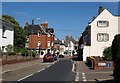
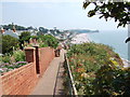
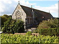
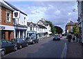
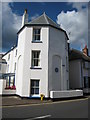
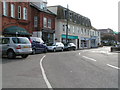
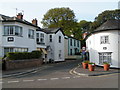
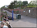
100 photos from this area
Area Information
Key information about the EX9 6JY including its size, population, and administrative classification.
- Area Type
- Postcode
- Area Size
- 1.1 hectares
- Population
- 1387
- Population Density
- 1746 people/km²
House Prices in EX9 6JY
12
Properties
£688,500
Average Sold Price
£240,000
Lowest Price
£1,540,000
Highest Price
Showing 12 properties
| Address | Type | Beds | Baths | Last Sale Price | Last Sale Date | |
|---|---|---|---|---|---|---|
| 9 Cliff Terrace, Budleigh Salterton, EX9 6JY | Semi-detached | 4 | 1 | £825,000 | May 2021 | |
| 5 Cliff Terrace, Budleigh Salterton, EX9 6JY | Flat | 2 | 2 | £698,000 | Jun 2019 | |
| 7 Cliff Terrace, Budleigh Salterton, EX9 6JY | house | 5 | - | £1,540,000 | Oct 2013 | |
| 3 Cliff Terrace, Budleigh Salterton, EX9 6JY | Terraced | 4 | 3 | £830,000 | Apr 2013 | |
| 2 Cliff Terrace, Budleigh Salterton, EX9 6JY | house | - | - | £660,000 | Jan 2011 | |
| 10 Cliff Terrace, Budleigh Salterton, EX9 6JY | Flat | - | - | £375,000 | Dec 2000 | |
| 6 Cliff Terrace, Budleigh Salterton, EX9 6JY | Flat | 2 | 2 | £340,000 | Jun 1999 | |
| 1 Cliff Terrace, Budleigh Salterton, EX9 6JY | Terraced | 4 | 3 | £240,000 | Sep 1996 | |
| 4 Cliff Terrace, Budleigh Salterton, EX9 6JY | Semi-detached | - | - | - | - | |
| 5A Cliff Terrace, Budleigh Salterton, EX9 6JY | Flat | - | - | - | - |
Page 1 of 2
Energy Efficiency in EX9 6JY
Amenities
Schools
| Rank | School | Type | Entry gender | Ages |
|---|
Explore more schools in this area
Go to Schools tabDemographics
Household Size
Two person
most common
Accommodation Type
Houses
most common
Tenure
83
majority
Ethnic Group
White
most common
Religion
N/A
most common
Household Composition
N/A
most common
Age
70
median
Elderly (65+ years)
most common
Household Deprivation
N/A
with no deprivation
NS-SEC
48
in Lower managerial occupations
Explore more demographic insights in this area
Go to Demographics tabPlanning
Planning Constraints
- Flood RiskPremium
- Ramsar Wetland SitesPremium
- Area of Outstanding Natural BeautyPremium
- Protected Nature ReservePremium
- Protected WoodlandPremium