Area Overview for EX9 6AP
Photos of EX9 6AP
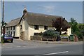
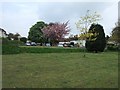
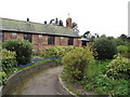
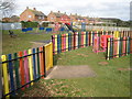
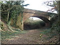
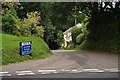
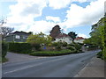
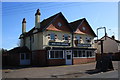


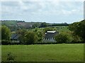
47 photos from this area
Area Information
Key information about the EX9 6AP including its size, population, and administrative classification.
- Area Type
- Postcode
- Area Size
- 5.5 hectares
- Population
- 1587
- Population Density
- 624 people/km²
House Prices in EX9 6AP
13
Properties
£238,750
Average Sold Price
£101,500
Lowest Price
£335,000
Highest Price
Showing 13 properties
| Address | Type | Beds | Baths | Last Sale Price | Last Sale Date | |
|---|---|---|---|---|---|---|
| 26 Knowle Village, Knowle, Budleigh Salterton, EX9 6AP | Semi-detached | 4 | - | £191,000 | Jul 2014 | |
| 25 Knowle Village, Knowle, Budleigh Salterton, EX9 6AP | Semi-detached | 3 | - | £235,000 | Sep 2004 | |
| The Stone Barn, Knowle Village, Knowle, Budleigh Salterton, EX9 6AP | Detached | - | - | £295,000 | Aug 2004 | |
| Aller House, Knowle Village, Knowle, Budleigh Salterton, EX9 6AP | Maisonette | - | - | £335,000 | Jan 2004 | |
| Rayden House, Knowle Village, Knowle, Budleigh Salterton, EX9 6AP | Terraced | 2 | 1 | £275,000 | Jun 2002 | |
| The Old Barn, Knowle Village, Knowle, Budleigh Salterton, EX9 6AP | Detached | - | - | £101,500 | Jan 1995 | |
| Welcott House, Knowle Village, Knowle, Budleigh Salterton, EX9 6AP | Maisonette | 4 | 3 | - | - | |
| The Cottage, Knowlecroft, Knowle Village, Knowle, Budleigh Salterton, EX9 6AP | Detached | 4 | 3 | - | - | |
| Knowlecroft, Knowle Village, Knowle, Budleigh Salterton, EX9 6AP | Detached | 4 | - | - | - | |
| Knowle Barton, Knowle Village, Knowle, Budleigh Salterton, EX9 6AP | house | - | - | - | - |
Page 1 of 2
Energy Efficiency in EX9 6AP
Amenities
Schools
| Rank | School | Type | Entry gender | Ages |
|---|
Explore more schools in this area
Go to Schools tabDemographics
Household Size
Two person
most common
Accommodation Type
Houses
most common
Tenure
83
majority
Ethnic Group
White
most common
Religion
N/A
most common
Household Composition
N/A
most common
Age
70
median
Elderly (65+ years)
most common
Household Deprivation
N/A
with no deprivation
NS-SEC
46
in Lower managerial occupations
Explore more demographic insights in this area
Go to Demographics tabPlanning
Planning Constraints
- Flood RiskPremium
- Ramsar Wetland SitesPremium
- Area of Outstanding Natural BeautyPremium
- Protected Nature ReservePremium
- Protected WoodlandPremium