Area Overview for EX8 5JU
Photos of EX8 5JU
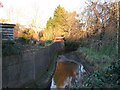
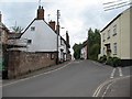
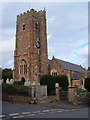
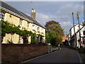
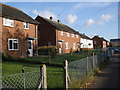


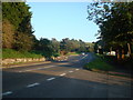
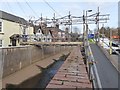

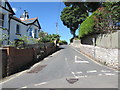
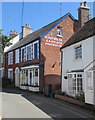
100 photos from this area
Area Information
Key information about the EX8 5JU including its size, population, and administrative classification.
- Area Type
- Postcode
- Area Size
- 1.9 hectares
- Population
- 1838
- Population Density
- 1739 people/km²
House Prices in EX8 5JU
15
Properties
£566,167
Average Sold Price
£260,000
Lowest Price
£1,500,000
Highest Price
Showing 15 properties
| Address | Type | Beds | Baths | Last Sale Price | Last Sale Date | |
|---|---|---|---|---|---|---|
| Town Dairy Cottage, Church Road, Lympstone, EX8 5JU | Terraced | 3 | 1 | £590,000 | Mar 2025 | |
| The Lodge, Church Road, Lympstone, EX8 5JU | Bungalow | - | - | £1,500,000 | Apr 2024 | |
| Haymore Thatch, Church Road, Lympstone, EX8 5JU | Cottage | 3 | - | £382,000 | Mar 2017 | |
| Daisy Cottage, 1 Church Road, Lympstone, EX8 5JU | Terraced | 6 | 4 | £260,000 | Jul 2013 | |
| Dingles, 3 Church Road, Lympstone, EX8 5JU | Terraced | 3 | - | £310,000 | Jul 2013 | |
| Church Cottage, Church Road, Lympstone, EX8 5JU | Detached | 3 | - | £355,000 | Mar 2004 | |
| Meadowgate, Church Road, Lympstone, EX8 5JU | house | - | - | - | - | |
| The Retreat, Church Road, Lympstone, EX8 5JU | Detached | 5 | 3 | - | - | |
| Lympstone Nurseries, Church Road, Lympstone, EX8 5JU | Farm | - | - | - | - | |
| 2 Church Road, Lympstone, EX8 5JU | Detached | 3 | - | - | - |
Page 1 of 2
Energy Efficiency in EX8 5JU
Amenities
Schools
| Rank | School | Type | Entry gender | Ages |
|---|
Explore more schools in this area
Go to Schools tabDemographics
Household Size
Two person
most common
Accommodation Type
Houses
most common
Tenure
69
majority
Ethnic Group
White
most common
Religion
N/A
most common
Household Composition
N/A
most common
Age
47
median
Adults (30-64 years)
most common
Household Deprivation
N/A
with no deprivation
NS-SEC
50
in Lower managerial occupations
Explore more demographic insights in this area
Go to Demographics tabPlanning
Planning Constraints
- Flood RiskPremium
- Ramsar Wetland SitesPremium
- Area of Outstanding Natural BeautyPremium
- Protected Nature ReservePremium
- Protected WoodlandPremium