Area Overview for EX8 5JF
Photos of EX8 5JF
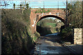
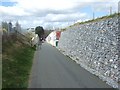
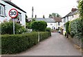
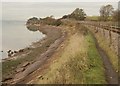
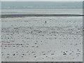
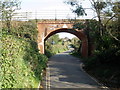
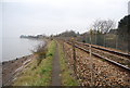
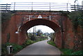
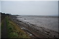

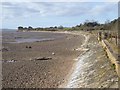
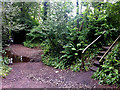
97 photos from this area
Area Information
Key information about the EX8 5JF including its size, population, and administrative classification.
- Area Type
- Postcode
- Area Size
- 2.0 hectares
- Population
- 1838
- Population Density
- 1739 people/km²
House Prices in EX8 5JF
29
Properties
£399,121
Average Sold Price
£139,950
Lowest Price
£700,000
Highest Price
Showing 29 properties
| Address | Type | Beds | Baths | Last Sale Price | Last Sale Date | |
|---|---|---|---|---|---|---|
| 32 Underhill Crescent, Lympstone, EX8 5JF | Bungalow | 3 | 2 | £570,000 | Aug 2025 | |
| 10 Underhill Crescent, Lympstone, EX8 5JF | Detached | 3 | 1 | £595,000 | Aug 2025 | |
| 2 Underhill Crescent, Lympstone, EX8 5JF | house | 3 | - | £587,500 | Feb 2022 | |
| 13 Underhill Crescent, Lympstone, EX8 5JF | house | - | - | £537,000 | Nov 2021 | |
| 19 Underhill Crescent, Lympstone, EX8 5JF | Detached | 3 | 2 | £485,000 | Dec 2020 | |
| 30 Underhill Crescent, Lympstone, EX8 5JF | Bungalow | 3 | - | £425,000 | Mar 2016 | |
| 17 Underhill Crescent, Lympstone, EX8 5JF | Bungalow | 3 | - | £335,907 | Jan 2015 | |
| 22 Underhill Crescent, Lympstone, EX8 5JF | Land | 4 | - | £700,000 | Jul 2014 | |
| 15 Underhill Crescent, Lympstone, EX8 5JF | Bungalow | - | - | £325,000 | Apr 2013 | |
| 21 Underhill Crescent, Lympstone, EX8 5JF | Detached | 3 | - | £345,000 | Feb 2013 |
Page 1 of 3
Energy Efficiency in EX8 5JF
Amenities
Schools
| Rank | School | Type | Entry gender | Ages |
|---|
Explore more schools in this area
Go to Schools tabDemographics
Household Size
Two person
most common
Accommodation Type
Houses
most common
Tenure
69
majority
Ethnic Group
White
most common
Religion
N/A
most common
Household Composition
N/A
most common
Age
47
median
Adults (30-64 years)
most common
Household Deprivation
N/A
with no deprivation
NS-SEC
50
in Lower managerial occupations
Explore more demographic insights in this area
Go to Demographics tabPlanning
Planning Constraints
- Flood RiskPremium
- Ramsar Wetland SitesPremium
- Area of Outstanding Natural BeautyPremium
- Protected Nature ReservePremium
- Protected WoodlandPremium