Area Overview for EX8 5HN
Photos of EX8 5HN

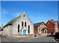

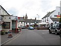
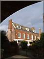

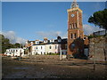


100 photos from this area
Area Information
Key information about the EX8 5HN including its size, population, and administrative classification.
- Area Type
- Postcode
- Area Size
- 8224 m²
- Population
- 1838
- Population Density
- 1739 people/km²
House Prices in EX8 5HN
8
Properties
£525,612
Average Sold Price
£249,995
Lowest Price
£800,000
Highest Price
Showing 8 properties
| Address | Type | Beds | Baths | Last Sale Price | Last Sale Date | |
|---|---|---|---|---|---|---|
| Wyndham, Burgmanns Hill, Lympstone, EX8 5HN | Bungalow | 3 | 1 | £505,000 | Mar 2023 | |
| Hillgate, Burgmanns Hill, Lympstone, EX8 5HN | Detached | - | - | £343,679 | Jun 2021 | |
| Fairways, Burgmanns Hill, Lympstone, EX8 5HN | Detached | 4 | 2 | £800,000 | Mar 2020 | |
| Corner House, Burgmanns Hill, Lympstone, EX8 5HN | Semi-detached | 5 | 2 | £780,000 | Mar 2016 | |
| Old Orchard, Burgmanns Hill, Lympstone, EX8 5HN | house | - | - | £475,000 | Dec 2015 | |
| Little Gables, Burgmanns Hill, Lympstone, EX8 5HN | Detached | - | - | £249,995 | Jun 2002 | |
| Hillcroft, Burgmanns Hill, Lympstone, EX8 5HN | Detached | - | - | - | - | |
| Tidewatch, Burgmanns Hill, Lympstone, EX8 5HN | Detached | - | - | - | - |
Energy Efficiency in EX8 5HN
Amenities
Schools
| Rank | School | Type | Entry gender | Ages |
|---|
Explore more schools in this area
Go to Schools tabDemographics
Household Size
Two person
most common
Accommodation Type
Houses
most common
Tenure
69
majority
Ethnic Group
White
most common
Religion
N/A
most common
Household Composition
N/A
most common
Age
47
median
Adults (30-64 years)
most common
Household Deprivation
N/A
with no deprivation
NS-SEC
50
in Lower managerial occupations
Explore more demographic insights in this area
Go to Demographics tabPlanning
Planning Constraints
- Flood RiskPremium
- Ramsar Wetland SitesPremium
- Area of Outstanding Natural BeautyPremium
- Protected Nature ReservePremium
- Protected WoodlandPremium