Area Overview for EX8 5AB
Photos of EX8 5AB

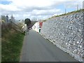
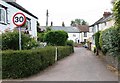
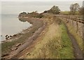


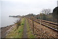
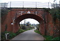
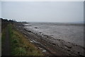

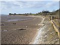
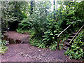
97 photos from this area
Area Information
Key information about the EX8 5AB including its size, population, and administrative classification.
- Area Type
- Postcode
- Area Size
- 21.6 hectares
- Population
- 1775
- Population Density
- 93 people/km²
House Prices in EX8 5AB
20
Properties
£1,081,167
Average Sold Price
£245,000
Lowest Price
£3,030,000
Highest Price
Showing 20 properties
| Address | Type | Beds | Baths | Last Sale Price | Last Sale Date | |
|---|---|---|---|---|---|---|
| Hidden House, Courtlands Lane, Exmouth, EX8 5AB | house | - | - | £1,775,000 | Mar 2023 | |
| North Lodge, Courtlands Lane, Exmouth, EX8 5AB | Detached | 4 | 3 | £3,030,000 | Sep 2022 | |
| Trelissa, Courtlands Lane, Exmouth, EX8 5AB | house | - | - | £790,000 | Aug 2018 | |
| Chatterpark, Courtlands Lane, Exmouth, EX8 5AB | house | - | - | £900,000 | Jan 2018 | |
| River Lea, Courtlands Lane, Exmouth, EX8 5AB | Detached | 4 | 3 | £1,205,000 | Jan 2015 | |
| Spinnaker, Courtlands Lane, Exmouth, EX8 5AB | house | 3 | - | £592,000 | Sep 2012 | |
| Runaway, Courtlands Lane, Exmouth, EX8 5AB | Detached | 4 | 2 | £693,500 | Aug 2012 | |
| Long Park, Courtlands Lane, Exmouth, EX8 5AB | Detached | - | - | £500,000 | Nov 2007 | |
| Sowden Lodge, Courtlands Lane, Exmouth, EX8 5AB | Detached | - | - | £245,000 | Aug 1995 | |
| Sowden Gatehouse, Courtlands Lane, Exmouth, EX8 5AB | Detached | 4 | 3 | - | - |
Page 1 of 2
Energy Efficiency in EX8 5AB
Amenities
Schools
| Rank | School | Type | Entry gender | Ages |
|---|
Explore more schools in this area
Go to Schools tabDemographics
Household Size
Two person
most common
Accommodation Type
Houses
most common
Tenure
84
majority
Ethnic Group
White
most common
Religion
N/A
most common
Household Composition
N/A
most common
Age
22
median
Young Adults (15-29 years)
most common
Household Deprivation
N/A
with no deprivation
NS-SEC
41
in Lower managerial occupations
Explore more demographic insights in this area
Go to Demographics tabPlanning
Planning Constraints
- Flood RiskPremium
- Ramsar Wetland SitesPremium
- Area of Outstanding Natural BeautyPremium
- Protected Nature ReservePremium
- Protected WoodlandPremium