Area Overview for EX7 9SG
Photos of EX7 9SG
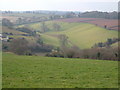
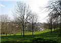
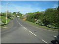
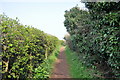
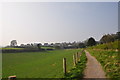
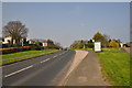
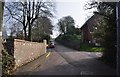
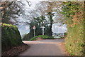
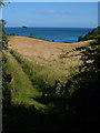
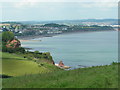
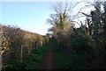
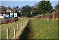
100 photos from this area
Area Information
Key information about the EX7 9SG including its size, population, and administrative classification.
- Area Type
- Postcode
- Area Size
- 1.4 hectares
- Population
- 1838
- Population Density
- 954 people/km²
House Prices in EX7 9SG
12
Properties
£223,359
Average Sold Price
£59,000
Lowest Price
£310,000
Highest Price
Showing 12 properties
| Address | Type | Beds | Baths | Last Sale Price | Last Sale Date | |
|---|---|---|---|---|---|---|
| 12 Old Farm Way, Dawlish, EX7 9SG | Retail | 3 | 1 | £310,000 | Dec 2021 | |
| 11 Old Farm Way, Dawlish, EX7 9SG | Bungalow | 3 | 1 | £306,000 | Dec 2021 | |
| 9 Old Farm Way, Dawlish, EX7 9SG | Bungalow | 2 | 1 | £271,000 | Nov 2020 | |
| 2 Old Farm Way, Dawlish, EX7 9SG | house | - | - | £275,000 | Jan 2020 | |
| 7 Old Farm Way, Dawlish, EX7 9SG | Semi-detached | 3 | 2 | £220,000 | May 2019 | |
| 3 Old Farm Way, Dawlish, EX7 9SG | Semi-detached | 3 | 1 | £230,000 | Apr 2019 | |
| 4 Old Farm Way, Dawlish, EX7 9SG | Semi-detached | 4 | - | £220,000 | Apr 2016 | |
| 1 Old Farm Way, Dawlish, EX7 9SG | house | 4 | - | £262,500 | Jan 2012 | |
| 8 Old Farm Way, Dawlish, EX7 9SG | house | - | - | £203,500 | Apr 2010 | |
| 10 Old Farm Way, Dawlish, EX7 9SG | house | - | - | £99,950 | Mar 2000 |
Page 1 of 2
Energy Efficiency in EX7 9SG
Amenities
Schools
| Rank | School | Type | Entry gender | Ages |
|---|
Explore more schools in this area
Go to Schools tabDemographics
Household Size
Two person
most common
Accommodation Type
Houses
most common
Tenure
89
majority
Ethnic Group
White
most common
Religion
N/A
most common
Household Composition
N/A
most common
Age
47
median
Elderly (65+ years)
most common
Household Deprivation
N/A
with no deprivation
NS-SEC
43
in Lower managerial occupations
Explore more demographic insights in this area
Go to Demographics tabPlanning
Planning Constraints
- Flood RiskPremium
- Ramsar Wetland SitesPremium
- Area of Outstanding Natural BeautyPremium
- Protected Nature ReservePremium
- Protected WoodlandPremium