Area Overview for EX7 9LW
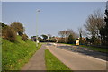
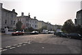
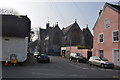
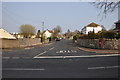
Photos of EX7 9LW


Area Information
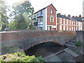
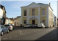
Living in EX7 9LW offers a quiet, residential lifestyle in a small cluster of homes with a population of 1,825. The area is defined by its proximity to coastal and rural amenities, with easy access to nearby towns like Dawlish and Teignmouth. Daily life here is shaped by a mature community, with residents predominantly aged 30–64, many of whom own their homes. The area’s compact size means most amenities are within walking or short driving distance, while the surrounding landscape provides a balance of natural and urban features. Residents benefit from nearby rail connections, ferry services, and a mix of local shops. Though small, EX7 9LW is well-connected to larger regional hubs, making it a practical choice for those seeking a peaceful yet accessible location. The absence of major environmental constraints, such as protected woodlands or flood zones, adds to its appeal for families and retirees alike.
- Area Type
- Postcode
- Area Size
- Not available
- Population
- 1825
- Population Density
- 2210 people/km²
The property market in EX7 9LW is dominated by owner-occupied homes, with 72% of properties owned outright. This contrasts with areas where rental demand drives the market, suggesting a focus on long-term residency rather than investment. The accommodation type is primarily houses, which is typical for regions with older housing stock and smaller populations. This mix implies a limited number of properties available, particularly for buyers seeking a range of options. The area’s small size means the housing stock is concentrated, and proximity to nearby towns like Dawlish may offer additional choices for those willing to commute. For buyers, the emphasis on owner-occupied homes could indicate a competitive market, with fewer properties coming up for sale. However, the absence of planning constraints or environmental restrictions may make it an attractive option for those prioritising stability over rapid growth.
House Prices in EX7 9LW
No properties found in this postcode.
Energy Efficiency in EX7 9LW
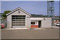
Residents of EX7 9LW have access to a variety of amenities within practical reach. Local retail options include Co-op Dawlish, Sainsburys Dawlish, and Spar, providing essential shopping needs. The rail network offers frequent services to nearby towns, while ferry landings connect to coastal destinations, enhancing both practicality and leisure opportunities. The area’s proximity to natural landscapes, combined with its small-town charm, suggests a lifestyle that balances convenience with tranquillity. For those who enjoy outdoor activities, the surrounding environment likely includes walking trails or scenic views. The mix of retail, transport, and coastal access contributes to a lifestyle that is both functional and appealing to those seeking a relaxed yet connected community.
Amenities
Schools
The nearest school to EX7 9LW is Lanherne School, an independent institution. While no Ofsted rating is provided, independent schools typically offer smaller class sizes and specialised curricula, which may appeal to families seeking alternative educational pathways. The presence of a single school in the area suggests that families may need to consider commuting to nearby towns for additional options, though Lanherne’s independent status could provide a distinct educational environment. The lack of state schools in the immediate vicinity means parents should assess whether the school’s offerings align with their children’s needs. For those prioritising private education, Lanherne’s location within practical reach of EX7 9LW makes it a viable option.
| Rank | School | Type | Entry gender | Ages |
|---|
Explore more schools in this area
Go to Schools tabDemographics
The community in EX7 9LW is predominantly composed of adults aged 30–64, with a median age of 47. This suggests a mature, stable population, many of whom are likely to be in their peak working years or retired. Home ownership is high at 72%, indicating a strong presence of long-term residents and a lower proportion of rental properties. The area is characterised by houses rather than flats, which aligns with the demographic profile of older, family-oriented households. The predominant ethnic group is White, reflecting a homogenous community. While no specific data on deprivation is provided, the high home ownership rate and age profile suggest a relatively stable economic environment. This stability may contribute to a sense of continuity and neighbourliness, though the small population size means social interactions are likely to be closely knit.
Household Size
Accommodation Type
Tenure
Ethnic Group
Religion
Household Composition
Age
Household Deprivation
NS-SEC
Explore more demographic insights in this area
Go to Demographics tabPlanning
Planning Constraints
- Flood RiskPremium
- Ramsar Wetland SitesPremium
- Area of Outstanding Natural BeautyPremium
- Protected Nature ReservePremium
- Protected WoodlandPremium