Area Overview for EX7 9JB
Photos of EX7 9JB
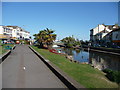
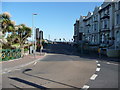
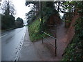
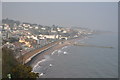
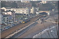
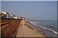
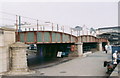
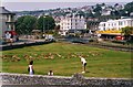

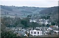
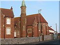
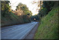
100 photos from this area
Area Information
Key information about the EX7 9JB including its size, population, and administrative classification.
- Area Type
- Postcode
- Area Size
- 6561 m²
- Population
- 1721
- Population Density
- 6118 people/km²
House Prices in EX7 9JB
11
Properties
£413,000
Average Sold Price
£250,000
Lowest Price
£539,000
Highest Price
Showing 11 properties
| Address | Type | Beds | Baths | Last Sale Price | Last Sale Date | |
|---|---|---|---|---|---|---|
| Cove View, The Drive, Dawlish, EX7 9JB | Detached | 8 | 4 | £539,000 | Mar 2020 | |
| Sherwell, The Drive, Dawlish, EX7 9JB | Detached | - | - | £450,000 | Jul 2004 | |
| Bay Tree House, The Drive, Dawlish, EX7 9JB | Detached | - | - | £250,000 | Mar 1999 | |
| Apartment 2, East Cliff House, The Drive, Dawlish, EX7 9JB | Retail | 2 | 1 | - | - | |
| Apartment 4, East Cliff House, The Drive, Dawlish, EX7 9JB | Semi-detached | 2 | 1 | - | - | |
| Merrihill, The Drive, Dawlish, EX7 9JB | house | 4 | 1 | - | - | |
| Apartment 1, East Cliff House, The Drive, Dawlish, EX7 9JB | Flat | - | - | - | - | |
| Apartment 3, East Cliff House, The Drive, Dawlish, EX7 9JB | Flat | - | - | - | - | |
| First Floor Flat, 23 Exeter Road, Dawlish, EX7 9JB | undefined | - | - | - | - | |
| Ground Floor Flat, 23 Exeter Road, Dawlish, EX7 9JB | undefined | - | - | - | - |
Page 1 of 2
Energy Efficiency in EX7 9JB
Amenities
Schools
| Rank | School | Type | Entry gender | Ages |
|---|
Explore more schools in this area
Go to Schools tabDemographics
Household Size
One person
most common
Accommodation Type
Flats
most common
Tenure
47
majority
Ethnic Group
White
most common
Religion
N/A
most common
Household Composition
N/A
most common
Age
47
median
Adults (30-64 years)
most common
Household Deprivation
N/A
with no deprivation
NS-SEC
27
in Lower managerial occupations
Explore more demographic insights in this area
Go to Demographics tabPlanning
Planning Constraints
- Flood RiskPremium
- Ramsar Wetland SitesPremium
- Area of Outstanding Natural BeautyPremium
- Protected Nature ReservePremium
- Protected WoodlandPremium