Area Overview for EX6 8TD
Photos of EX6 8TD


Area Information
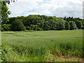
Living in EX6 8TD offers a quiet, residential experience within a small cluster of homes in England. With a population of 1,902 and a density of 211 people per square kilometre, the area is compact yet well-served by nearby amenities. The community is characterised by a mature demographic, with a median age of 47 and a strong presence of adults aged 30–64. This suggests a stable, established neighbourhood where many residents are likely to be long-term residents. The area’s proximity to transport links, including rail stations and ferry services, ensures easy access to nearby towns and cities. Daily life here is shaped by a balance of local shops, schools, and natural surroundings. The low flood risk and below-average crime rates further enhance its appeal as a safe, low-stress environment. For those seeking a peaceful yet connected lifestyle, EX6 8TD provides a blend of residential tranquillity and practical accessibility to essential services.
- Area Type
- Postcode
- Area Size
- Not available
- Population
- 1902
- Population Density
- 211 people/km²
The property market in EX6 8TD is dominated by owner-occupied homes, with 71% of properties owned by residents rather than rented. This suggests a community of long-term residents and a lower turnover of properties compared to rental-heavy areas. The accommodation type is primarily houses, which is typical for smaller, rural or semi-rural postcode areas. This housing stock may appeal to buyers seeking traditional family homes with garden space, though the limited number of properties in the area means the market is likely small and niche. The high home ownership rate also indicates that property values may be relatively stable, with fewer speculative investments. For buyers, this means a focus on individual properties rather than large-scale development, and a need to consider the local character and constraints of the area when evaluating potential purchases.
House Prices in EX6 8TD
No properties found in this postcode.
Energy Efficiency in EX6 8TD
The lifestyle in EX6 8TD is enriched by a range of nearby amenities within practical reach. Residents can access five ferry landings, including Turf Lock Inn Ferry Landing, which offer scenic and functional transport options. Retail choices include major chains like Tesco Exminster and Co-op Topsham, alongside Aldi Countess, ensuring daily essentials are easily obtainable. The area is served by five rail stations, such as Topsham Railway Station, connecting to Exeter and other destinations. For those needing air travel, Exeter International Airport is within reach. While specific parks or leisure facilities are not detailed in the data, the presence of multiple transport and retail hubs suggests a community focused on convenience and accessibility. The mix of local shops, transport links, and nearby services creates a practical, connected lifestyle, ideal for those valuing ease of access over sprawling urban amenities.
Amenities
Schools
Residents of EX6 8TD have access to two notable schools within reach. Exminster Community Primary is a state-funded primary school with a good Ofsted rating, offering a reliable foundation for younger children. For those seeking independent education, Exeter Pre-Prep School provides an outstanding-rated alternative, catering to younger students with a focus on academic and personal development. The mix of state and independent schools gives families flexibility in choosing educational paths, whether prioritising affordability or specialised curricula. Both institutions are within practical reach of the area, reducing the need for long commutes. The presence of a high-rated independent school may also attract families seeking premium education options, while the state school ensures accessibility for all residents. This combination supports a diverse range of family needs in the area.
| Rank | School | Type | Entry gender | Ages |
|---|
Explore more schools in this area
Go to Schools tabDemographics
The community in EX6 8TD is predominantly composed of adults aged 30–64, reflecting a mature population with a median age of 47. Home ownership is high, at 71%, indicating a strong presence of long-term residents and a stable housing market. The area is largely made up of houses rather than flats or apartments, aligning with the residential character of the postcode. The predominant ethnic group is White, though specific data on diversity or deprivation is not provided. This demographic profile suggests a community focused on family life and long-term settlement, with fewer transient populations. The age range implies a mix of working-age adults and retirees, potentially supporting local services and amenities. The absence of detailed diversity metrics means the area’s social composition remains largely unexplored in the data, but the high home ownership rate and stable age distribution point to a cohesive, established neighbourhood.
Household Size
Accommodation Type
Tenure
Ethnic Group
Religion
Household Composition
Age
Household Deprivation
NS-SEC
Explore more demographic insights in this area
Go to Demographics tabPlanning
Planning Constraints
- Flood RiskPremium
- Ramsar Wetland SitesPremium
- Area of Outstanding Natural BeautyPremium
- Protected Nature ReservePremium
- Protected WoodlandPremium