Area Overview for EX6 8RB
Photos of EX6 8RB
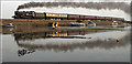
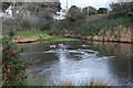
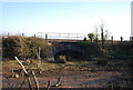
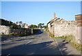
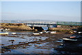
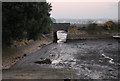

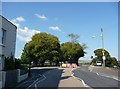
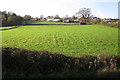
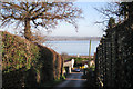
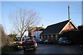
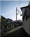
100 photos from this area
Area Information
Key information about the EX6 8RB including its size, population, and administrative classification.
- Area Type
- Postcode
- Area Size
- 35.0 hectares
- Population
- 1519
- Population Density
- 514 people/km²
House Prices in EX6 8RB
57
Properties
£368,672
Average Sold Price
£72,500
Lowest Price
£950,000
Highest Price
Showing 57 properties
| Address | Type | Beds | Baths | Last Sale Price | Last Sale Date | |
|---|---|---|---|---|---|---|
| 3A Cofton Hill, Cockwood, EX6 8RB | Detached | 3 | 1 | £290,000 | Sep 2025 | |
| 5 Cofton Hill, Cockwood, EX6 8RB | house | 3 | 1 | £450,000 | Apr 2024 | |
| Highview, Cofton Hill, Cockwood, EX6 8RB | Detached | 4 | 3 | £610,000 | May 2023 | |
| 36 Cofton Hill, Cockwood, EX6 8RB | Detached | 4 | 4 | £950,000 | Jun 2022 | |
| Woodview, Cofton Hill, Cockwood, EX6 8RB | Bungalow | 3 | 1 | £400,000 | May 2022 | |
| 11 Cofton Hill, Cockwood, EX6 8RB | Detached | 4 | 2 | £520,000 | Aug 2020 | |
| 3 Cofton Hill, Cockwood, EX6 8RB | Detached | 2 | - | £225,000 | Feb 2018 | |
| 25 Cofton Hill, Cockwood, EX6 8RB | Bungalow | - | - | £565,000 | Oct 2017 | |
| 46B Cofton Hill, Cockwood, EX6 8RB | Detached | 4 | 2 | £495,000 | Sep 2017 | |
| 28 Cofton Hill, Cockwood, EX6 8RB | house | - | - | £360,000 | Mar 2017 |
Page 1 of 6
Energy Efficiency in EX6 8RB
Amenities
Schools
| Rank | School | Type | Entry gender | Ages |
|---|
Explore more schools in this area
Go to Schools tabDemographics
Household Size
Two person
most common
Accommodation Type
Houses
most common
Tenure
77
majority
Ethnic Group
White
most common
Religion
N/A
most common
Household Composition
N/A
most common
Age
47
median
Adults (30-64 years)
most common
Household Deprivation
N/A
with no deprivation
NS-SEC
33
in Lower managerial occupations
Explore more demographic insights in this area
Go to Demographics tabPlanning
Planning Constraints
- Flood RiskPremium
- Ramsar Wetland SitesPremium
- Area of Outstanding Natural BeautyPremium
- Protected Nature ReservePremium
- Protected WoodlandPremium