Area Overview for EX6 8BU
Photos of EX6 8BU


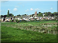
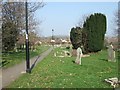


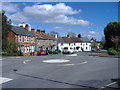
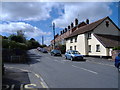

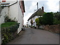
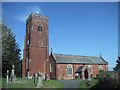
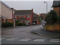
92 photos from this area
Area Information
Key information about the EX6 8BU including its size, population, and administrative classification.
- Area Type
- Postcode
- Area Size
- 2.1 hectares
- Population
- 1902
- Population Density
- 211 people/km²
House Prices in EX6 8BU
11
Properties
£276,450
Average Sold Price
£66,000
Lowest Price
£600,000
Highest Price
Showing 11 properties
| Address | Type | Beds | Baths | Last Sale Price | Last Sale Date | |
|---|---|---|---|---|---|---|
| 3, Spurfield Cottages, Main Road, Exminster, EX6 8BU | Semi-detached | 3 | 2 | £335,000 | Jul 2025 | |
| Spurfield House, Main Road, Exminster, EX6 8BU | hospital_care_home | - | - | £600,000 | Jul 2022 | |
| 5, Spurfield Cottages, Main Road, Exminster, EX6 8BU | Semi-detached | 3 | 1 | £260,000 | Aug 2019 | |
| Spurways, Main Road, Exminster, EX6 8BU | Bungalow | 6 | 3 | £395,000 | Aug 2016 | |
| The Old Police House, Main Road, Exminster, EX6 8BU | Detached | 3 | - | £345,000 | Oct 2013 | |
| 6, Spurfield Cottages, Main Road, Exminster, EX6 8BU | Semi-detached | 3 | 1 | £208,800 | Aug 2010 | |
| 4, Spurfield Cottages, Main Road, Exminster, EX6 8BU | Semi-detached | - | - | £205,000 | Aug 2005 | |
| 2, Spurfield Cottages, Main Road, Exminster, EX6 8BU | Semi-detached | 3 | 1 | £73,250 | Dec 1999 | |
| 1, Spurfield Cottages, Main Road, Exminster, EX6 8BU | house | 3 | 1 | £66,000 | Oct 1999 | |
| 6A, Spurfield Cottages, Main Road, Exminster, EX6 8BU | Terraced | - | - | - | - |
Page 1 of 2
Energy Efficiency in EX6 8BU
Amenities
Schools
| Rank | School | Type | Entry gender | Ages |
|---|
Explore more schools in this area
Go to Schools tabDemographics
Household Size
Two person
most common
Accommodation Type
Houses
most common
Tenure
71
majority
Ethnic Group
White
most common
Religion
N/A
most common
Household Composition
N/A
most common
Age
47
median
Adults (30-64 years)
most common
Household Deprivation
N/A
with no deprivation
NS-SEC
38
in Lower managerial occupations
Explore more demographic insights in this area
Go to Demographics tabPlanning
Planning Constraints
- Flood RiskPremium
- Ramsar Wetland SitesPremium
- Area of Outstanding Natural BeautyPremium
- Protected Nature ReservePremium
- Protected WoodlandPremium