Area Overview for EX5 7DR
Photos of EX5 7DR
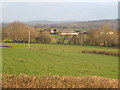
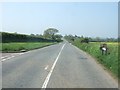
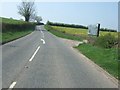


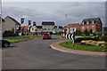
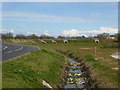
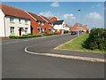
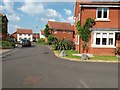
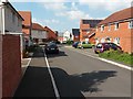
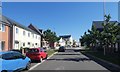
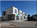
50 photos from this area
Area Information
Key information about the EX5 7DR including its size, population, and administrative classification.
- Area Type
- Postcode
- Area Size
- 1.5 hectares
- Population
- 1245
- Population Density
- 6991 people/km²
House Prices in EX5 7DR
84
Properties
£185,472
Average Sold Price
£83,600
Lowest Price
£310,000
Highest Price
Showing 84 properties
| Address | Type | Beds | Baths | Last Sale Price | Last Sale Date | |
|---|---|---|---|---|---|---|
| 123 Younghayes Road, Cranbrook, EX5 7DR | Semi-detached | 3 | 2 | £234,000 | Mar 2025 | |
| 7 Younghayes Road, Cranbrook, EX5 7DR | Semi-detached | 4 | 3 | £310,000 | Jun 2024 | |
| 61 Younghayes Road, Cranbrook, EX5 7DR | Flat | - | - | £126,000 | Apr 2024 | |
| 11 Younghayes Road, Cranbrook, EX5 7DR | Terraced | 3 | 2 | £285,000 | Apr 2023 | |
| 95 Younghayes Road, Cranbrook, EX5 7DR | Terraced | 2 | 1 | £225,000 | Mar 2023 | |
| 91 Younghayes Road, Cranbrook, EX5 7DR | Terraced | 2 | 2 | £227,000 | Nov 2022 | |
| 59 Younghayes Road, Cranbrook, EX5 7DR | Flat | - | - | £152,000 | Oct 2022 | |
| 45 Younghayes Road, Cranbrook, EX5 7DR | Flat | 2 | 1 | £126,750 | Oct 2021 | |
| 185 Younghayes Road, Cranbrook, EX5 7DR | Semi-detached | 3 | 2 | £260,000 | Sep 2021 | |
| 55 Younghayes Road, Cranbrook, EX5 7DR | Detached | 5 | 3 | £136,500 | Sep 2021 |
Page 1 of 9
Energy Efficiency in EX5 7DR
Amenities
Schools
| Rank | School | Type | Entry gender | Ages |
|---|
Explore more schools in this area
Go to Schools tabDemographics
Household Size
Family (3-5 people)
most common
Accommodation Type
Houses
most common
Tenure
65
majority
Ethnic Group
White
most common
Religion
N/A
most common
Household Composition
N/A
most common
Age
47
median
Adults (30-64 years)
most common
Household Deprivation
N/A
with no deprivation
NS-SEC
39
in Lower managerial occupations
Explore more demographic insights in this area
Go to Demographics tabPlanning
Planning Constraints
- Flood RiskPremium
- Ramsar Wetland SitesPremium
- Area of Outstanding Natural BeautyPremium
- Protected Nature ReservePremium
- Protected WoodlandPremium