Area Overview for EX5 5HG
Photos of EX5 5HG
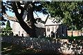
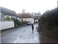
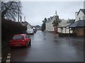
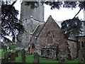
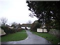
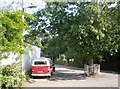
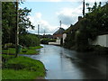
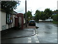
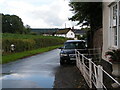
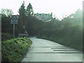
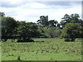

58 photos from this area
Area Information
Key information about the EX5 5HG including its size, population, and administrative classification.
- Area Type
- Postcode
- Area Size
- 6.3 hectares
- Population
- 2155
- Population Density
- 73 people/km²
House Prices in EX5 5HG
15
Properties
£319,409
Average Sold Price
£50,000
Lowest Price
£720,000
Highest Price
Showing 15 properties
| Address | Type | Beds | Baths | Last Sale Price | Last Sale Date | |
|---|---|---|---|---|---|---|
| 4 Chapel Road, Brampford Speke, EX5 5HG | Cottage | 4 | 1 | £410,000 | Apr 2025 | |
| Peppercorn Cottage, Road From Hillcott To Damar, Brampford Speke, EX5 5HG | Semi-detached | 3 | - | £300,000 | Feb 2024 | |
| Chimney Cottage, Road From Hillcott To Damar, Brampford Speke, EX5 5HG | house | - | - | £50,000 | Jun 2022 | |
| Exe View, Road From Lakes Bridge To North End, Brampford Speke, EX5 5HG | house | - | - | £426,000 | Jul 2019 | |
| 2 Chapel Road, Brampford Speke, EX5 5HG | Terraced | 2 | 1 | £220,000 | Sep 2018 | |
| 3 Chapel Road, Brampford Speke, EX5 5HG | Terraced | 2 | 1 | £180,000 | May 2018 | |
| Site Of Milton Lodge, Road From Chimney Cottage To Taylors Farm, Brampford Speke, EX5 5HG | Detached | 5 | 5 | £720,000 | Feb 2018 | |
| Barnhill, Road From Hillcott To Damar, Brampford Speke, EX5 5HG | house | 6 | - | £320,000 | Apr 2012 | |
| River View, Road From Hillcott To Damar, Brampford Speke, EX5 5HG | house | 4 | 3 | £490,000 | May 2007 | |
| 6 Chapel Road, Brampford Speke, EX5 5HG | Semi-detached | - | - | £305,000 | Aug 2006 |
Page 1 of 2
Energy Efficiency in EX5 5HG
Amenities
Schools
| Rank | School | Type | Entry gender | Ages |
|---|
Explore more schools in this area
Go to Schools tabDemographics
Household Size
Two person
most common
Accommodation Type
Houses
most common
Tenure
75
majority
Ethnic Group
White
most common
Religion
N/A
most common
Household Composition
N/A
most common
Age
47
median
Adults (30-64 years)
most common
Household Deprivation
N/A
with no deprivation
NS-SEC
39
in Lower managerial occupations
Explore more demographic insights in this area
Go to Demographics tabPlanning
Planning Constraints
- Flood RiskPremium
- Ramsar Wetland SitesPremium
- Area of Outstanding Natural BeautyPremium
- Protected Nature ReservePremium
- Protected WoodlandPremium