Area Overview for EX5 4DZ
Photos of EX5 4DZ

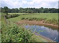
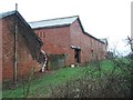
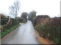
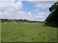

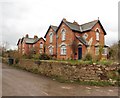
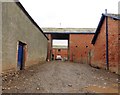
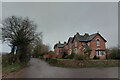
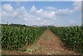
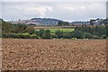
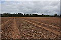
26 photos from this area
Area Information
Key information about the EX5 4DZ including its size, population, and administrative classification.
- Area Type
- Postcode
- Area Size
- 1.6 km²
- Population
- 2155
- Population Density
- 73 people/km²
House Prices in EX5 4DZ
16
Properties
£581,500
Average Sold Price
£368,000
Lowest Price
£795,000
Highest Price
Showing 16 properties
| Address | Type | Beds | Baths | Last Sale Price | Last Sale Date | |
|---|---|---|---|---|---|---|
| Netherexe House, Lane Past Netherexe Barton, Netherexe, EX5 4DZ | Detached | 6 | 4 | £795,000 | Nov 2019 | |
| Barnfield East, Lane Past Netherexe Barton, Netherexe, EX5 4DZ | house | - | - | £368,000 | Mar 2018 | |
| Barnfield West, Lane Past Netherexe Barton, Netherexe, EX5 4DZ | Semi-detached | 4 | 2 | - | - | |
| Old Barton House, Lane Past Netherexe Barton, Netherexe, EX5 4DZ | Detached | 6 | 3 | - | - | |
| Old Barton Barn West, Lane Past Netherexe Barton, Netherexe, EX5 4DZ | house | - | - | - | - | |
| The Coach House, Lane Past Netherexe Barton, Netherexe, EX5 4DZ | house | - | - | - | - | |
| Little Meadow, Lane Past Netherexe Barton, Netherexe, EX5 4DZ | Detached | - | - | - | - | |
| K H May And Partners, Netherexe Barton, Road From Latchmoor Cross To Barnfield Cottages, Netherexe, EX5 4DZ | Farm | - | - | - | - | |
| 1, Barnfield Cottages, Lane Past Netherexe Barton, Netherexe, EX5 4DZ | Semi-detached | - | - | - | - | |
| Dairy House, Lane Past Netherexe Barton, Netherexe, EX5 4DZ | house | - | - | - | - |
Page 1 of 2
Energy Efficiency in EX5 4DZ
Amenities
Schools
| Rank | School | Type | Entry gender | Ages |
|---|
Explore more schools in this area
Go to Schools tabDemographics
Household Size
Two person
most common
Accommodation Type
Houses
most common
Tenure
75
majority
Ethnic Group
White
most common
Religion
N/A
most common
Household Composition
N/A
most common
Age
47
median
Adults (30-64 years)
most common
Household Deprivation
N/A
with no deprivation
NS-SEC
39
in Lower managerial occupations
Explore more demographic insights in this area
Go to Demographics tabPlanning
Planning Constraints
- Flood RiskPremium
- Ramsar Wetland SitesPremium
- Area of Outstanding Natural BeautyPremium
- Protected Nature ReservePremium
- Protected WoodlandPremium