Area Overview for EX4 8WA
Photos of EX4 8WA


Area Information
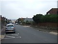
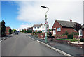
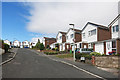
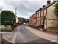
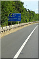
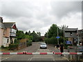
Living in EX4 8WA means being part of a small, tightly knit residential cluster in England, where the population of 1742 reflects a quiet, stable community. This area is defined by its proximity to Exeter International Airport, offering easy access to regional and international travel, while remaining rooted in local charm. Daily life here is shaped by a balance of practicality and accessibility, with nearby amenities like Spar, Lidl, and Aldi ensuring essential shopping needs are met. The area’s character is anchored by its housing stock, which predominantly consists of family homes, appealing to those seeking a settled lifestyle. With a median age of 47 and a strong presence of adults aged 30–64, the community is mature and likely to prioritise stability. The low crime risk, combined with minimal environmental constraints, makes EX4 8WA a place where safety and convenience coexist. For buyers, this postcode offers a rare blend of small-area living with sufficient infrastructure to support both daily routines and broader aspirations.
- Area Type
- Postcode
- Area Size
- Not available
- Population
- Not available
- Population Density
- Not available
The property market in EX4 8WA is dominated by owner-occupied homes, with 84% of properties owned outright. This high rate of home ownership suggests a community focused on long-term investment rather than short-term rental opportunities. The accommodation type is predominantly houses, which is unusual for a small postcode area but indicates a preference for larger, family-friendly properties. This housing stock likely appeals to buyers seeking spacious, stable homes in a low-risk environment. The area’s limited size means the market is relatively contained, with properties potentially commanding higher value due to their rarity in the region. For buyers, this presents an opportunity to secure a home in a safe, established area with minimal planning constraints. However, the small footprint of the postcode means competition for properties may be keen, particularly for those prioritising proximity to nearby amenities like schools and transport links.
House Prices in EX4 8WA
No properties found in this postcode.
Energy Efficiency in EX4 8WA
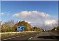
Life in EX4 8WA is supported by a range of nearby amenities that cater to daily needs and leisure. The area’s retail options include Spar, Lidl Venny, and Aldi Whipton, ensuring residents have access to essential groceries and convenience stores. For commuters, five rail stations—Pinhoe, Polsloe Bridge, Digby & Sowton—offer regular services to Exeter and surrounding areas, making it easy to connect to larger cities. The proximity to Exeter International Airport adds to the area’s appeal for those requiring frequent travel. On water, three ferry landings—Topsham, Topsham Lock, and Turf Lock Inn—provide access to local waterways, ideal for leisurely trips or commuting along the river. These amenities combine practicality with accessibility, allowing residents to balance local convenience with broader regional opportunities. The mix of retail, transport, and water-based access creates a lifestyle that is both self-sufficient and connected to wider networks.
Amenities
Schools
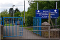
The nearest school to EX4 8WA is Pinhoe Church of England Primary School & Nursery, which serves the local community with a good Ofsted rating. This primary school is a key asset for families, offering a solid foundation for early education. The absence of secondary schools in the immediate vicinity means students may need to travel to nearby towns for further education, but the primary school’s quality ensures a strong start. The single school listed in the data highlights the area’s focus on primary education, which is typical for smaller residential clusters. For parents, this means a reliable local option for younger children, though secondary schooling would require planning for commuting. The good Ofsted rating reflects effective teaching and facilities, reinforcing the area’s appeal to families prioritising educational standards.
| Rank | School | Type | Entry gender | Ages |
|---|
Explore more schools in this area
Go to Schools tabDemographics
The community in EX4 8WA is predominantly composed of adults aged 30–64, with a median age of 47. This suggests a population that is largely established, with many likely to be in their prime working years or nearing retirement. Home ownership is exceptionally high at 84%, indicating a strong preference for long-term residency over rental living. The accommodation type is primarily houses, which aligns with the area’s character as a residential cluster rather than a high-density development. The predominant ethnic group is White, though the data does not provide further breakdowns on diversity. This demographic profile points to a community that values stability and family-oriented living. With no specific data on deprivation, it is reasonable to infer that the area’s infrastructure and amenities meet the needs of its residents, supporting a quality of life that aligns with the region’s broader economic and social context.
Household Size
Accommodation Type
Tenure
Ethnic Group
Religion
Household Composition
Age
Household Deprivation
NS-SEC
Explore more demographic insights in this area
Go to Demographics tabPlanning
Planning Constraints
- Flood RiskPremium
- Ramsar Wetland SitesPremium
- Area of Outstanding Natural BeautyPremium
- Protected Nature ReservePremium
- Protected WoodlandPremium