Area Overview for EX4 6TD
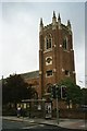
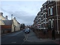
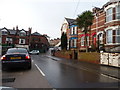
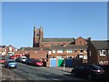
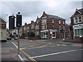
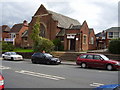
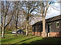
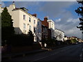
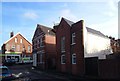
Photos of EX4 6TD


Area Information
Living in EX4 6TD offers a snapshot of a small, tightly knit residential cluster in England, where the population of 1,587 residents reflects a community shaped by proximity to Exeter’s urban infrastructure. This postcode area, though modest in size, is positioned near key transport hubs and amenities, making it practical for those seeking a balance between suburban tranquillity and city accessibility. The demographic profile is distinctly young, with a median age of 22 and the majority of residents falling within the 15–29 age range. This suggests a community skewed toward students, early-career professionals, or those in transient housing, such as rental properties. Daily life here is likely characterised by a reliance on nearby rail links and retail outlets, with the area’s compact nature fostering a sense of familiarity among residents. The absence of significant environmental constraints, such as protected woodlands or flood-prone zones, further underscores its appeal as a low-risk, functional living space. For those prioritising safety and practicality, EX4 6TD presents a straightforward option, though its small scale means it is more of a satellite node than a standalone neighbourhood.
- Area Type
- Postcode
- Area Size
- Not available
- Population
- Not available
- Population Density
- Not available
The property market in EX4 6TD is characterised by a low home ownership rate of 38%, suggesting that the area is more rental-focused than owner-occupied. This aligns with the predominance of houses as the primary accommodation type, which may cater to families or individuals seeking more space, though the small population raises questions about the typical household size. Given the area’s compact nature, the housing stock is likely limited, with few new developments to expand the market. For buyers, this means competition may be minimal, but the small scale of the area could limit options for those seeking larger properties or long-term investment. The rental market, however, is likely active, particularly among students or young professionals drawn to the area’s proximity to transport links and amenities. Buyers should consider whether the low ownership rate reflects affordability or a lack of demand for permanent residences.
House Prices in EX4 6TD
No properties found in this postcode.
Energy Efficiency in EX4 6TD
Residents of EX4 6TD have access to a range of amenities within practical reach, including five retail outlets such as Co-op Exeter, Tesco Sidwell, and Morrisons Daily Brentwood, ensuring everyday shopping needs are met. The area’s proximity to three ferry landings and multiple railway stations enhances mobility, while Exeter International Airport provides direct access to national and international travel. Though the data does not specify parks or leisure facilities, the presence of multiple retail and transport hubs suggests a lifestyle focused on convenience and connectivity. The mix of retail, transport, and travel options implies a community that values accessibility over expansive recreational spaces, making it practical for those prioritising ease of movement over large-scale amenities.
Amenities
Schools
The nearest school to EX4 6TD is Emmanuel School Exeter, an independent institution. This school type implies it is likely fee-paying, catering to families seeking private education. While no other schools are listed in the data, the presence of an independent school suggests that families in the area may prioritise private education options, potentially influencing housing choices. However, the absence of state schools or other educational institutions in the immediate vicinity could limit choices for those seeking public schooling or a broader range of educational providers. For parents considering EX4 6TD, the availability of only one school type means careful consideration of the school’s curriculum, fees, and accessibility is essential.
| Rank | School | Type | Entry gender | Ages |
|---|
Explore more schools in this area
Go to Schools tabDemographics
The population of EX4 6TD is overwhelmingly young, with a median age of 22 and 70% of residents falling within the 15–29 age bracket. This demographic skew suggests a community dominated by students, recent graduates, or those in entry-level employment, likely contributing to a transient housing market. Home ownership is relatively low at 38%, indicating that a significant portion of the area’s housing stock is rented out, possibly to students or short-term tenants. The predominant accommodation type is houses, which may reflect a preference for family-sized homes or properties with more space, though the small population suggests many are single occupants or small households. The predominant ethnic group is White, with no data provided on other groups. The age profile and ownership rates imply a dynamic but potentially unstable community, where property values may be influenced more by rental demand than long-term residency.
Household Size
Accommodation Type
Tenure
Ethnic Group
Religion
Household Composition
Age
Household Deprivation
NS-SEC
Explore more demographic insights in this area
Go to Demographics tabPlanning
Planning Constraints
- Flood RiskPremium
- Ramsar Wetland SitesPremium
- Area of Outstanding Natural BeautyPremium
- Protected Nature ReservePremium
- Protected WoodlandPremium