Area Overview for EX4 5AU
Photos of EX4 5AU
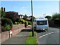
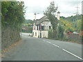
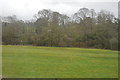
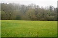
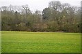
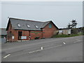
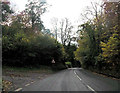
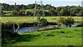
31 photos from this area
Area Information
Key information about the EX4 5AU including its size, population, and administrative classification.
- Area Type
- Postcode
- Area Size
- 6067 m²
- Population
- 3565
- Population Density
- 1848 people/km²
House Prices in EX4 5AU
13
Properties
£256,786
Average Sold Price
£71,000
Lowest Price
£380,000
Highest Price
Showing 13 properties
| Address | Type | Beds | Baths | Last Sale Price | Last Sale Date | |
|---|---|---|---|---|---|---|
| 3 Wrefords Drive, Exeter, EX4 5AU | Detached | 3 | 1 | £300,000 | Jan 2025 | |
| 21 Wrefords Drive, Exeter, EX4 5AU | Detached | 3 | 1 | £355,000 | Aug 2021 | |
| 24 Wrefords Drive, Exeter, EX4 5AU | Detached | 4 | 1 | £380,000 | Jan 2020 | |
| 19 Wrefords Drive, Exeter, EX4 5AU | Detached | 4 | 1 | £308,500 | Jan 2015 | |
| 9 Wrefords Drive, Exeter, EX4 5AU | Detached | 3 | 1 | £224,000 | Oct 2009 | |
| 17 Wrefords Drive, Exeter, EX4 5AU | Detached | - | - | £159,000 | Aug 2002 | |
| 7 Wrefords Drive, Exeter, EX4 5AU | Detached | - | - | £71,000 | Feb 1996 | |
| 1 Wrefords Drive, Exeter, EX4 5AU | Detached | 3 | 1 | - | - | |
| 15 Wrefords Drive, Exeter, EX4 5AU | Detached | 4 | 2 | - | - | |
| University Topsham Sports Ground, Stoke Road, Exeter, EX4 5AU | Leisure | - | - | - | - |
Page 1 of 2
Energy Efficiency in EX4 5AU
Amenities
Schools
| Rank | School | Type | Entry gender | Ages |
|---|
Explore more schools in this area
Go to Schools tabDemographics
Household Size
Two person
most common
Accommodation Type
Houses
most common
Tenure
89
majority
Ethnic Group
White
most common
Religion
N/A
most common
Household Composition
N/A
most common
Age
22
median
Young Adults (15-29 years)
most common
Household Deprivation
N/A
with no deprivation
NS-SEC
15
in Lower managerial occupations
Explore more demographic insights in this area
Go to Demographics tabPlanning
Planning Constraints
- Flood RiskPremium
- Ramsar Wetland SitesPremium
- Area of Outstanding Natural BeautyPremium
- Protected Nature ReservePremium
- Protected WoodlandPremium