Area Overview for EX4 3SD
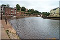
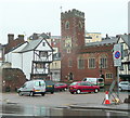
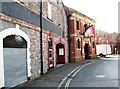
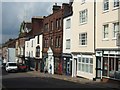
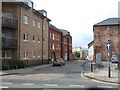
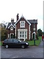
Photos of EX4 3SD


Area Information
Living in EX4 3SD means being part of a compact, residential postcode area in England with a population of 2,797. The area is defined by its proximity to Exeter’s urban core, offering easy access to the city’s amenities while maintaining a distinct, small-scale character. With a median age of 22 and a majority of residents aged 15–29, this is a young, dynamic area. Daily life is shaped by the prevalence of flats, reflecting a rental-heavy market. The area is well-connected, with multiple railway stations, ferry landings, and Exeter International Airport nearby. Residents benefit from retail options like Co-op Exeter and Sainsburys, as well as educational institutions such as Exeter College. However, the high crime risk score of 17 means safety is a concern. Despite this, the area’s compact size and transport links make it a practical choice for those prioritising accessibility over seclusion.
- Area Type
- Postcode
- Area Size
- Not available
- Population
- 2797
- Population Density
- 6181 people/km²
The property market in EX4 3SD is characterised by a high rental proportion, with only 31% of residents owning their homes. The accommodation type is almost exclusively flats, indicating a lack of larger houses or family homes. This suggests the area is not ideal for buyers seeking long-term ownership or space for growing families. The small postcode area means housing stock is limited, and competition for available properties may be intense. Given the young demographic, the market is likely to cater to short-term tenants or those prioritising location over property size. Buyers should consider the area’s limited housing diversity and the potential for fluctuating rental demand.
House Prices in EX4 3SD
No properties found in this postcode.
Energy Efficiency in EX4 3SD
Residents of EX4 3SD have access to a range of amenities within practical reach. Retail options include Co-op Exeter, Sainsburys Exeter, and M&S Exeter, ensuring everyday shopping needs are met. The area’s rail network and ferry landings facilitate easy travel to Exeter’s city centre and surrounding regions. The presence of Exeter International Airport adds to the area’s connectivity. While the data does not mention parks or leisure facilities, the proximity to Exeter suggests access to larger recreational spaces. The combination of retail, transport, and travel options creates a convenient, urban lifestyle, though local leisure opportunities may be limited.
Amenities
Schools
The nearest school to EX4 3SD is Exeter College, a sixth-form institution. No primary or secondary schools are listed in the data, which may pose challenges for families with younger children. The absence of local schools means residents must rely on nearby institutions in Exeter or surrounding areas. For those requiring sixth-form education, Exeter College provides access to higher-level studies, though it does not cater to younger age groups. The lack of school diversity in the immediate vicinity could influence decisions about where to live, particularly for families with children.
| Rank | School | Type | Entry gender | Ages |
|---|
Explore more schools in this area
Go to Schools tabDemographics
EX4 3SD has a median age of 22, with the most common age range being young adults (15–29 years). This suggests a community skewed towards students, graduates, or young professionals. Only 31% of residents own their homes, indicating a rental-dominated market. The accommodation type is predominantly flats, reflecting a lack of larger family homes. The predominant ethnic group is White, though no further diversity data is provided. With such a young population, the area likely experiences high turnover, as renters may move frequently. The low home ownership rate also implies limited long-term investment in property. For those considering this area, the demographic profile suggests a transient, urbanised environment rather than a family-oriented community.
Household Size
Accommodation Type
Tenure
Ethnic Group
Religion
Household Composition
Age
Household Deprivation
NS-SEC
Explore more demographic insights in this area
Go to Demographics tabPlanning
Planning Constraints
- Flood RiskPremium
- Ramsar Wetland SitesPremium
- Area of Outstanding Natural BeautyPremium
- Protected Nature ReservePremium
- Protected WoodlandPremium