Area Overview for EX4 2PN
Photos of EX4 2PN
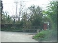
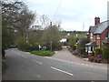
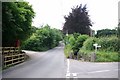
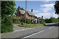

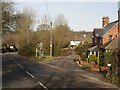
55 photos from this area
Area Information
Key information about the EX4 2PN including its size, population, and administrative classification.
- Area Type
- Postcode
- Area Size
- 6.3 hectares
- Population
- 1370
- Population Density
- 38 people/km²
House Prices in EX4 2PN
14
Properties
£181,921
Average Sold Price
£75,950
Lowest Price
£287,500
Highest Price
Showing 14 properties
| Address | Type | Beds | Baths | Last Sale Price | Last Sale Date | |
|---|---|---|---|---|---|---|
| 1 Snowdrop Mews, Exeter, EX4 2PN | Semi-detached | 3 | 1 | £277,500 | Mar 2025 | |
| 12 Snowdrop Mews, Exeter, EX4 2PN | Semi-detached | 3 | 1 | £287,500 | Aug 2023 | |
| 14 Snowdrop Mews, Exeter, EX4 2PN | Detached | 4 | 2 | £250,000 | Aug 2019 | |
| 2 Snowdrop Mews, Exeter, EX4 2PN | Semi-detached | 3 | 1 | £205,000 | Mar 2018 | |
| 11 Snowdrop Mews, Exeter, EX4 2PN | Detached | 4 | 1 | £225,000 | Dec 2012 | |
| 6 Snowdrop Mews, Exeter, EX4 2PN | Detached | - | - | £230,000 | Nov 2009 | |
| 7 Snowdrop Mews, Exeter, EX4 2PN | Detached | - | - | £209,000 | Jan 2007 | |
| 5 Snowdrop Mews, Exeter, EX4 2PN | Detached | - | - | £169,950 | Oct 2003 | |
| 13 Snowdrop Mews, Exeter, EX4 2PN | Semi-detached | - | - | £134,000 | Jul 2003 | |
| 8 Snowdrop Mews, Exeter, EX4 2PN | Detached | - | - | £156,000 | Feb 2003 |
Page 1 of 2
Energy Efficiency in EX4 2PN
Amenities
Schools
| Rank | School | Type | Entry gender | Ages |
|---|
Explore more schools in this area
Go to Schools tabDemographics
Household Size
Two person
most common
Accommodation Type
Houses
most common
Tenure
81
majority
Ethnic Group
White
most common
Religion
N/A
most common
Household Composition
N/A
most common
Age
47
median
Adults (30-64 years)
most common
Household Deprivation
N/A
with no deprivation
NS-SEC
37
in Lower managerial occupations
Explore more demographic insights in this area
Go to Demographics tabPlanning
Planning Constraints
- Flood RiskPremium
- Ramsar Wetland SitesPremium
- Area of Outstanding Natural BeautyPremium
- Protected Nature ReservePremium
- Protected WoodlandPremium