Area Overview for EX4 2NB
Photos of EX4 2NB
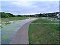
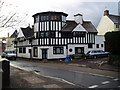
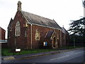
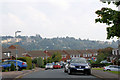


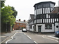
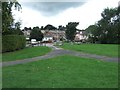


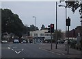

100 photos from this area
Area Information
Key information about the EX4 2NB including its size, population, and administrative classification.
- Area Type
- Postcode
- Area Size
- 1.4 hectares
- Population
- 1699
- Population Density
- 4160 people/km²
House Prices in EX4 2NB
51
Properties
£152,966
Average Sold Price
£40,000
Lowest Price
£230,000
Highest Price
Showing 51 properties
| Address | Type | Beds | Baths | Last Sale Price | Last Sale Date | |
|---|---|---|---|---|---|---|
| 133 Farm Hill, Exeter, EX4 2NB | Terraced | 2 | 1 | £170,000 | Sep 2025 | |
| 160 Farm Hill, Exeter, EX4 2NB | Terraced | 2 | 1 | £188,000 | Aug 2025 | |
| 175 Farm Hill, Exeter, EX4 2NB | house | - | - | £230,000 | Aug 2025 | |
| 153 Farm Hill, Exeter, EX4 2NB | Terraced | 3 | 1 | £227,000 | Aug 2024 | |
| 164 Farm Hill, Exeter, EX4 2NB | Terraced | 3 | 1 | £215,000 | Jul 2024 | |
| 158 Farm Hill, Exeter, EX4 2NB | Terraced | 2 | 1 | £215,000 | Nov 2023 | |
| 149 Farm Hill, Exeter, EX4 2NB | Terraced | 3 | 1 | £230,000 | Sep 2023 | |
| 178 Farm Hill, Exeter, EX4 2NB | Retail | 3 | 1 | £210,000 | Nov 2022 | |
| 136 Farm Hill, Exeter, EX4 2NB | Terraced | 3 | 1 | £217,000 | Aug 2022 | |
| 177 Farm Hill, Exeter, EX4 2NB | house | - | - | £190,000 | Apr 2021 |
Page 1 of 6
Energy Efficiency in EX4 2NB
Amenities
Schools
| Rank | School | Type | Entry gender | Ages |
|---|
Explore more schools in this area
Go to Schools tabDemographics
Household Size
Two person
most common
Accommodation Type
Houses
most common
Tenure
49
majority
Ethnic Group
White
most common
Religion
N/A
most common
Household Composition
N/A
most common
Age
47
median
Adults (30-64 years)
most common
Household Deprivation
N/A
with no deprivation
NS-SEC
26
in Lower managerial occupations
Explore more demographic insights in this area
Go to Demographics tabPlanning
Planning Constraints
- Flood RiskPremium
- Ramsar Wetland SitesPremium
- Area of Outstanding Natural BeautyPremium
- Protected Nature ReservePremium
- Protected WoodlandPremium