Area Overview for EX4 2EL
Photos of EX4 2EL


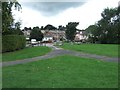


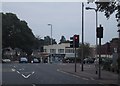

100 photos from this area
Area Information
Key information about the EX4 2EL including its size, population, and administrative classification.
- Area Type
- Postcode
- Area Size
- 2.7 hectares
- Population
- Not available
- Population Density
- Not available
House Prices in EX4 2EL
37
Properties
£190,062
Average Sold Price
£44,000
Lowest Price
£384,000
Highest Price
Showing 37 properties
| Address | Type | Beds | Baths | Last Sale Price | Last Sale Date | |
|---|---|---|---|---|---|---|
| 29 Cheltenham Close, Exeter, EX4 2EL | Terraced | 2 | 1 | £269,000 | Nov 2024 | |
| 13 Cheltenham Close, Exeter, EX4 2EL | house | - | - | £384,000 | Jul 2022 | |
| 27 Cheltenham Close, Exeter, EX4 2EL | house | 2 | 1 | £245,000 | Apr 2022 | |
| 21 Cheltenham Close, Exeter, EX4 2EL | Semi-detached | 3 | 1 | £230,000 | Feb 2022 | |
| 12 Cheltenham Close, Exeter, EX4 2EL | Semi-detached | 4 | - | £332,000 | Dec 2020 | |
| 33 Cheltenham Close, Exeter, EX4 2EL | Detached | 4 | 1 | £310,000 | Mar 2020 | |
| 17 Cheltenham Close, Exeter, EX4 2EL | Terraced | 2 | 1 | £203,000 | Apr 2019 | |
| 28 Cheltenham Close, Exeter, EX4 2EL | Terraced | 2 | 1 | £192,000 | Sep 2017 | |
| 3 Cheltenham Close, Exeter, EX4 2EL | Detached | 6 | 2 | £293,500 | Sep 2016 | |
| 24 Cheltenham Close, Exeter, EX4 2EL | Terraced | 2 | - | £177,000 | Aug 2016 |
Page 1 of 4
Energy Efficiency in EX4 2EL
Amenities
Schools
| Rank | School | Type | Entry gender | Ages |
|---|
Explore more schools in this area
Go to Schools tabDemographics
Household Size
Two person
most common
Accommodation Type
Houses
most common
Tenure
63
majority
Ethnic Group
White
most common
Religion
N/A
most common
Household Composition
N/A
most common
Age
47
median
Adults (30-64 years)
most common
Household Deprivation
N/A
with no deprivation
NS-SEC
23
in Lower managerial occupations
Explore more demographic insights in this area
Go to Demographics tabPlanning
Planning Constraints
- Flood RiskPremium
- Ramsar Wetland SitesPremium
- Area of Outstanding Natural BeautyPremium
- Protected Nature ReservePremium
- Protected WoodlandPremium