Area Overview for EX4 2AW
Photos of EX4 2AW
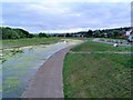
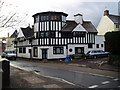
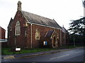
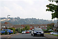
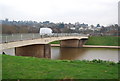

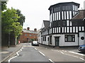
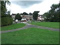
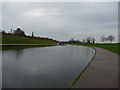
100 photos from this area
Area Information
Key information about the EX4 2AW including its size, population, and administrative classification.
- Area Type
- Postcode
- Area Size
- 1.2 hectares
- Population
- 1454
- Population Density
- 4188 people/km²
House Prices in EX4 2AW
19
Properties
£280,735
Average Sold Price
£69,600
Lowest Price
£510,000
Highest Price
Showing 19 properties
| Address | Type | Beds | Baths | Last Sale Price | Last Sale Date | |
|---|---|---|---|---|---|---|
| 53 Exwick Hill, Exeter, EX4 2AW | Detached | 4 | 1 | £450,000 | Sep 2025 | |
| 69 Exwick Hill, Exeter, EX4 2AW | Semi-detached | 2 | 1 | £206,000 | Oct 2023 | |
| 39 Exwick Hill, Exeter, EX4 2AW | Semi-detached | 2 | 1 | £510,000 | Mar 2022 | |
| 2, The Pines, Exwick Hill, Exeter, EX4 2AW | Bungalow | 4 | - | £485,000 | Nov 2018 | |
| 55 Exwick Hill, Exeter, EX4 2AW | Detached | 4 | 1 | £400,000 | Dec 2017 | |
| 61 Exwick Hill, Exeter, EX4 2AW | Terraced | 2 | 1 | £175,000 | Jul 2017 | |
| 51 Exwick Hill, Exeter, EX4 2AW | Detached | 4 | 1 | £375,000 | Jun 2014 | |
| 37 Exwick Hill, Exeter, EX4 2AW | Semi-detached | 2 | 1 | £249,950 | Oct 2009 | |
| 45 Exwick Hill, Exeter, EX4 2AW | Semi-detached | 2 | 1 | £285,000 | Sep 2009 | |
| 65 Exwick Hill, Exeter, EX4 2AW | Semi-detached | 2 | 1 | £139,000 | Jul 2004 |
Page 1 of 2
Energy Efficiency in EX4 2AW
Amenities
Schools
| Rank | School | Type | Entry gender | Ages |
|---|
Explore more schools in this area
Go to Schools tabDemographics
Household Size
Two person
most common
Accommodation Type
Houses
most common
Tenure
75
majority
Ethnic Group
White
most common
Religion
N/A
most common
Household Composition
N/A
most common
Age
47
median
Adults (30-64 years)
most common
Household Deprivation
N/A
with no deprivation
NS-SEC
27
in Lower managerial occupations
Explore more demographic insights in this area
Go to Demographics tabPlanning
Planning Constraints
- Flood RiskPremium
- Ramsar Wetland SitesPremium
- Area of Outstanding Natural BeautyPremium
- Protected Nature ReservePremium
- Protected WoodlandPremium