Area Overview for EX4 1EP
Photos of EX4 1EP
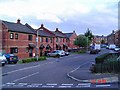

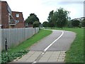
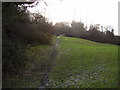
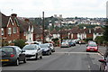
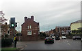
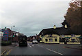
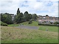
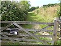

67 photos from this area
Area Information
Key information about the EX4 1EP including its size, population, and administrative classification.
- Area Type
- Postcode
- Area Size
- 1.1 hectares
- Population
- Not available
- Population Density
- Not available
House Prices in EX4 1EP
65
Properties
£174,479
Average Sold Price
£29,500
Lowest Price
£300,000
Highest Price
Showing 65 properties
| Address | Type | Beds | Baths | Last Sale Price | Last Sale Date | |
|---|---|---|---|---|---|---|
| 73 Okehampton Road, Exeter, EX4 1EP | Terraced | 2 | 1 | £260,000 | Jun 2024 | |
| 92 Okehampton Road, Exeter, EX4 1EP | Terraced | 3 | 1 | £300,000 | Dec 2022 | |
| 88 Okehampton Road, Exeter, EX4 1EP | Terraced | 3 | 1 | £245,000 | Apr 2022 | |
| 93 Okehampton Road, Exeter, EX4 1EP | house | 2 | 1 | £223,000 | Mar 2022 | |
| 3, Felixwell Court, Okehampton Road, Exeter, EX4 1EP | Flat | 1 | 1 | £172,500 | Nov 2021 | |
| 95 Okehampton Road, Exeter, EX4 1EP | Terraced | 2 | 1 | £232,000 | Sep 2021 | |
| 65 Okehampton Road, Exeter, EX4 1EP | Terraced | 3 | 1 | £227,500 | Aug 2020 | |
| 85 Okehampton Road, Exeter, EX4 1EP | Terraced | 3 | 1 | £196,250 | May 2020 | |
| 61 Okehampton Road, Exeter, EX4 1EP | Terraced | 3 | 1 | £212,500 | Feb 2020 | |
| 1, Felixwell Court, Okehampton Road, Exeter, EX4 1EP | Semi-detached | 5 | 1 | £275,000 | Sep 2019 |
Page 1 of 7
Energy Efficiency in EX4 1EP
Amenities
Schools
| Rank | School | Type | Entry gender | Ages |
|---|
Explore more schools in this area
Go to Schools tabDemographics
Household Size
Family (3-5 people)
most common
Accommodation Type
Houses
most common
Tenure
69
majority
Ethnic Group
White
most common
Religion
N/A
most common
Household Composition
N/A
most common
Age
47
median
Adults (30-64 years)
most common
Household Deprivation
N/A
with no deprivation
NS-SEC
36
in Lower managerial occupations
Explore more demographic insights in this area
Go to Demographics tabPlanning
Planning Constraints
- Flood RiskPremium
- Ramsar Wetland SitesPremium
- Area of Outstanding Natural BeautyPremium
- Protected Nature ReservePremium
- Protected WoodlandPremium