Area Overview for EX39 5JS
Photos of EX39 5JS

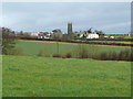
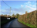
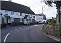
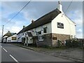
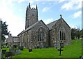
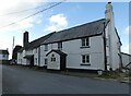

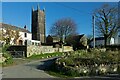

25 photos from this area
Area Information
Key information about the EX39 5JS including its size, population, and administrative classification.
- Area Type
- Postcode
- Area Size
- 4.7 hectares
- Population
- 1495
- Population Density
- 45 people/km²
House Prices in EX39 5JS
12
Properties
£327,408
Average Sold Price
£230,000
Lowest Price
£519,500
Highest Price
Showing 12 properties
| Address | Type | Beds | Baths | Last Sale Price | Last Sale Date | |
|---|---|---|---|---|---|---|
| Edgefield, Road From Town Farm To Cheznous, Monkleigh, EX39 5JS | Detached | 4 | 2 | £519,500 | Aug 2025 | |
| Monkswillow, Road From Town Farm To Cheznous, Monkleigh, EX39 5JS | house | - | - | £339,950 | Sep 2021 | |
| Corner House, Road From Town Farm To Cheznous, Monkleigh, EX39 5JS | Detached | 3 | 1 | £290,000 | Jan 2021 | |
| Kenscott, Road From Town Farm To Cheznous, Monkleigh, EX39 5JS | house | - | - | £255,000 | Dec 2020 | |
| Bell Cottage, Road From Town Farm To Cheznous, Monkleigh, EX39 5JS | Semi-detached | - | - | £330,000 | Oct 2019 | |
| Fourwinds, Road From Town Farm To Cheznous, Monkleigh, EX39 5JS | Bungalow | - | - | £230,000 | Nov 2014 | |
| Ancora, Road From Town Farm To Cheznous, Monkleigh, EX39 5JS | Detached | 3 | 1 | - | - | |
| The Flat, Ancora, Road From Town Farm To Cheznous, Monkleigh, EX39 5JS | Bungalow | - | - | - | - | |
| Flat, Bell Inn, Road From Town Farm To Cheznous, Monkleigh, EX39 5JS | Flat | - | - | - | - | |
| Town Farm, Road From Town Farm To Cheznous, Monkleigh, EX39 5JS | Detached | - | - | - | - |
Page 1 of 2
Energy Efficiency in EX39 5JS
Amenities
Schools
| Rank | School | Type | Entry gender | Ages |
|---|
Explore more schools in this area
Go to Schools tabDemographics
Household Size
Two person
most common
Accommodation Type
Houses
most common
Tenure
83
majority
Ethnic Group
White
most common
Religion
N/A
most common
Household Composition
N/A
most common
Age
47
median
Adults (30-64 years)
most common
Household Deprivation
N/A
with no deprivation
NS-SEC
34
in Lower managerial occupations
Explore more demographic insights in this area
Go to Demographics tabPlanning
Planning Constraints
- Flood RiskPremium
- Ramsar Wetland SitesPremium
- Area of Outstanding Natural BeautyPremium
- Protected Nature ReservePremium
- Protected WoodlandPremium