Area Overview for EX39 5HR
Photos of EX39 5HR
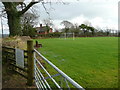
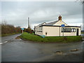

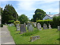

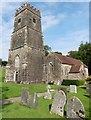
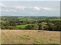
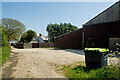
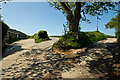

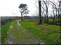
27 photos from this area
Area Information
Key information about the EX39 5HR including its size, population, and administrative classification.
- Area Type
- Postcode
- Area Size
- 47.4 hectares
- Population
- 1495
- Population Density
- 45 people/km²
House Prices in EX39 5HR
20
Properties
£351,939
Average Sold Price
£54,000
Lowest Price
£850,000
Highest Price
Showing 20 properties
| Address | Type | Beds | Baths | Last Sale Price | Last Sale Date | |
|---|---|---|---|---|---|---|
| 1, Red Cottages, Road From Apps Springs To Windward, Littleham, EX39 5HR | Semi-detached | 3 | 1 | £465,000 | Nov 2019 | |
| Beech House, Road From Apps Springs To Windward, Littleham, EX39 5HR | Detached | 4 | 2 | £540,000 | Nov 2019 | |
| Higher Barn, Road From Apps Springs To Windward, Littleham, EX39 5HR | Semi-detached | 3 | - | £242,000 | Sep 2018 | |
| The Shippen, Road From Apps Springs To Windward, Littleham, EX39 5HR | Semi-detached | 2 | - | £215,000 | Aug 2018 | |
| School House Farm, Road From Apps Springs To Windward, Littleham, EX39 5HR | office_workshop | - | - | £135,000 | Jan 2017 | |
| Old Stables, Road From Apps Springs To Windward, Littleham, EX39 5HR | house | - | - | £469,450 | Nov 2016 | |
| The Oaks, Road From Apps Springs To Windward, Littleham, EX39 5HR | house | 5 | - | £850,000 | Dec 2014 | |
| Barn View, Road From Apps Springs To Windward, Littleham, EX39 5HR | house | - | - | £197,000 | Aug 2007 | |
| Little Malt, Road From Apps Springs To Windward, Littleham, EX39 5HR | Bungalow | - | - | £54,000 | Dec 1996 | |
| Apps Farmhouse, Road From Apps Springs To Windward, Littleham, EX39 5HR | Land | - | - | - | - |
Page 1 of 2
Energy Efficiency in EX39 5HR
Amenities
Schools
| Rank | School | Type | Entry gender | Ages |
|---|
Explore more schools in this area
Go to Schools tabDemographics
Household Size
Two person
most common
Accommodation Type
Houses
most common
Tenure
83
majority
Ethnic Group
White
most common
Religion
N/A
most common
Household Composition
N/A
most common
Age
47
median
Adults (30-64 years)
most common
Household Deprivation
N/A
with no deprivation
NS-SEC
34
in Lower managerial occupations
Explore more demographic insights in this area
Go to Demographics tabPlanning
Planning Constraints
- Flood RiskPremium
- Ramsar Wetland SitesPremium
- Area of Outstanding Natural BeautyPremium
- Protected Nature ReservePremium
- Protected WoodlandPremium