Area Overview for EX39 5HB
Photos of EX39 5HB
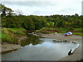
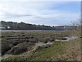
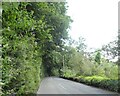
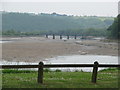
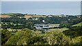
12 photos from this area
Area Information
Key information about the EX39 5HB including its size, population, and administrative classification.
- Area Type
- Postcode
- Area Size
- 21.0 hectares
- Population
- 2078
- Population Density
- 1545 people/km²
House Prices in EX39 5HB
5
Properties
£229,000
Average Sold Price
£130,000
Lowest Price
£328,000
Highest Price
Showing 5 properties
| Address | Type | Beds | Baths | Last Sale Price | Last Sale Date | |
|---|---|---|---|---|---|---|
| Forest Hill House, New Road, Bideford, EX39 5HB | Detached | - | - | £328,000 | Mar 2012 | |
| Riverside Cottage, Road From Coach Drive To Chapel Cottage, Bideford, EX39 5HB | house | - | - | £130,000 | Oct 1996 | |
| Higher Marsh, New Road, Bideford, EX39 5HB | Retail | 4 | 2 | - | - | |
| Annexe, Higher Marsh, New Road, Bideford, EX39 5HB | Flat | - | - | - | - | |
| Riverside Cottage Annexe, Road From Coach Drive To Chapel Cottage, Bideford, EX39 5HB | hotel | - | - | - | - |
Energy Efficiency in EX39 5HB
Amenities
Schools
| Rank | School | Type | Entry gender | Ages |
|---|
Explore more schools in this area
Go to Schools tabDemographics
Household Size
One person
most common
Accommodation Type
Houses
most common
Tenure
48
majority
Ethnic Group
White
most common
Religion
N/A
most common
Household Composition
N/A
most common
Age
47
median
Adults (30-64 years)
most common
Household Deprivation
N/A
with no deprivation
NS-SEC
20
in Lower managerial occupations
Explore more demographic insights in this area
Go to Demographics tabPlanning
Planning Constraints
- Flood RiskPremium
- Ramsar Wetland SitesPremium
- Area of Outstanding Natural BeautyPremium
- Protected Nature ReservePremium