Area Overview for EX39 5EE
Photos of EX39 5EE


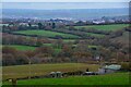
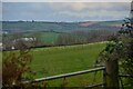
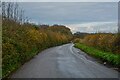
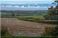
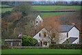
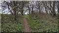
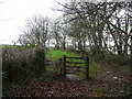
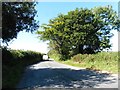
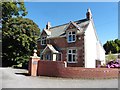
16 photos from this area
Area Information
Key information about the EX39 5EE including its size, population, and administrative classification.
- Area Type
- Postcode
- Area Size
- 1.4 km²
- Population
- 1755
- Population Density
- 42 people/km²
House Prices in EX39 5EE
23
Properties
£330,750
Average Sold Price
£96,500
Lowest Price
£565,000
Highest Price
Showing 23 properties
| Address | Type | Beds | Baths | Last Sale Price | Last Sale Date | |
|---|---|---|---|---|---|---|
| Woodside, Road From Clovelly Road To Littleham Cross, Littleham, EX39 5EE | Detached | 7 | 2 | £565,000 | May 2018 | |
| High Park Cottage, Road From Clovelly Road To Littleham Cross, Littleham, EX39 5EE | Bungalow | - | - | £96,500 | Jun 1999 | |
| High Park Lodge, Road From Clovelly Road To Littleham Cross, Littleham, EX39 5EE | Detached | 2 | 1 | - | - | |
| Lower Court, Winscott Barton, Road Southeast From Knotty Corner, Fairy Cross, EX39 5EE | Mobile Home | - | - | - | - | |
| Woodside Annexe, Road From Clovelly Road To Littleham Cross, Littleham, EX39 5EE | Bungalow | - | - | - | - | |
| Glee Barn, Road Southeast From Knotty Corner, Fairy Cross, EX39 5EE | house | - | - | - | - | |
| The Cottage, Road Southeast From Knotty Corner, Fairy Cross, EX39 5EE | hotel | - | - | - | - | |
| Cob Cottage, Road Southeast From Knotty Corner, Fairy Cross, EX39 5EE | Semi-detached | 1 | 1 | - | - | |
| Tumbledown Cottage, Road Southeast From Knotty Corner, Fairy Cross, EX39 5EE | Semi-detached | - | - | - | - | |
| The Warren, Road Southeast From Knotty Corner, Fairy Cross, EX39 5EE | Detached | - | - | - | - |
Page 1 of 3
Energy Efficiency in EX39 5EE
Amenities
Schools
| Rank | School | Type | Entry gender | Ages |
|---|
Explore more schools in this area
Go to Schools tabDemographics
Household Size
Two person
most common
Accommodation Type
Houses
most common
Tenure
79
majority
Ethnic Group
White
most common
Religion
N/A
most common
Household Composition
N/A
most common
Age
47
median
Adults (30-64 years)
most common
Household Deprivation
N/A
with no deprivation
NS-SEC
32
in Lower managerial occupations
Explore more demographic insights in this area
Go to Demographics tabPlanning
Planning Constraints
- Flood RiskPremium
- Ramsar Wetland SitesPremium
- Area of Outstanding Natural BeautyPremium
- Protected Nature ReservePremium
- Protected WoodlandPremium