Area Overview for EX39 5AZ
Photos of EX39 5AZ
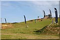
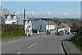
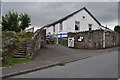


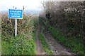
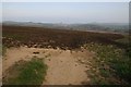
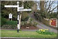
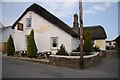

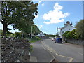

66 photos from this area
Area Information
Key information about the EX39 5AZ including its size, population, and administrative classification.
- Area Type
- Postcode
- Area Size
- 8.8 hectares
- Population
- 1755
- Population Density
- 42 people/km²
House Prices in EX39 5AZ
14
Properties
£244,995
Average Sold Price
£77,000
Lowest Price
£425,000
Highest Price
Showing 14 properties
| Address | Type | Beds | Baths | Last Sale Price | Last Sale Date | |
|---|---|---|---|---|---|---|
| Smithy Cottage, Pump Lane, Abbotsham, EX39 5AZ | house | - | - | £305,000 | Jan 2023 | |
| The Old Smithy, Pump Lane, Abbotsham, EX39 5AZ | Bungalow | 2 | 1 | £425,000 | Aug 2022 | |
| Meadowside, 1 Pump Lane, Abbotsham, EX39 5AZ | house | - | - | £340,000 | Jun 2022 | |
| Rose Cottage, Pump Lane, Abbotsham, EX39 5AZ | Semi-detached | 4 | 3 | £199,950 | Sep 2016 | |
| Silver Mist, Pump Lane, Abbotsham, EX39 5AZ | Detached | 4 | 2 | £365,000 | Jul 2013 | |
| Forge Cottage, Pump Lane, Abbotsham, EX39 5AZ | Detached | - | - | £300,000 | Apr 2006 | |
| Roseland, 3 Pump Lane, Abbotsham, EX39 5AZ | Semi-detached | - | - | £150,000 | May 2003 | |
| Thistles, Pump Lane, Abbotsham, EX39 5AZ | Detached | - | - | £195,000 | Apr 2003 | |
| Kenwith Cottage, 2 Pump Lane, Abbotsham, EX39 5AZ | Semi-detached | - | - | £77,000 | Nov 2000 | |
| Highdown, Pump Lane, Abbotsham, EX39 5AZ | Detached | - | - | £93,000 | Sep 1997 |
Page 1 of 2
Energy Efficiency in EX39 5AZ
Amenities
Schools
| Rank | School | Type | Entry gender | Ages |
|---|
Explore more schools in this area
Go to Schools tabDemographics
Household Size
Two person
most common
Accommodation Type
Houses
most common
Tenure
79
majority
Ethnic Group
White
most common
Religion
N/A
most common
Household Composition
N/A
most common
Age
47
median
Adults (30-64 years)
most common
Household Deprivation
N/A
with no deprivation
NS-SEC
32
in Lower managerial occupations
Explore more demographic insights in this area
Go to Demographics tabPlanning
Planning Constraints
- Flood RiskPremium
- Ramsar Wetland SitesPremium
- Area of Outstanding Natural BeautyPremium
- Protected Nature ReservePremium
- Protected WoodlandPremium