Area Overview for EX39 4NB
Photos of EX39 4NB

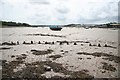
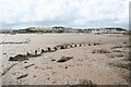
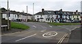
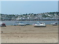
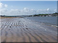
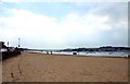
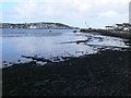
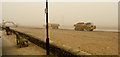
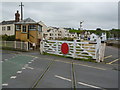
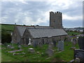
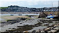
100 photos from this area
Area Information
Key information about the EX39 4NB including its size, population, and administrative classification.
- Area Type
- Postcode
- Area Size
- 7420 m²
- Population
- 1467
- Population Density
- 49 people/km²
House Prices in EX39 4NB
27
Properties
£256,850
Average Sold Price
£52,500
Lowest Price
£450,000
Highest Price
Showing 27 properties
| Address | Type | Beds | Baths | Last Sale Price | Last Sale Date | |
|---|---|---|---|---|---|---|
| 25 WHITE HOUSE CLOSE, Instow, EX39 4NB | Terraced | - | - | £410,000 | Mar 2023 | |
| 2 White House Close, Instow, EX39 4NB | Terraced | 2 | - | £395,000 | Nov 2022 | |
| 22 White House Close, Instow, EX39 4NB | house | 3 | 2 | £450,000 | Oct 2022 | |
| 17 White House Close, Instow, EX39 4NB | Detached | 3 | 2 | £377,000 | Mar 2021 | |
| 6 White House Close, Instow, EX39 4NB | Terraced | 2 | 1 | £319,050 | Mar 2021 | |
| 23 White House Close, Instow, EX39 4NB | Terraced | 3 | 1 | £265,000 | Jul 2019 | |
| 9 White House Close, Instow, EX39 4NB | Semi-detached | 3 | 1 | £295,000 | Apr 2018 | |
| 10 White House Close, Instow, EX39 4NB | Cottage | 2 | - | £375,000 | Dec 2009 | |
| 16 White House Close, Instow, EX39 4NB | Terraced | 3 | 1 | £265,000 | Nov 2005 | |
| 20 White House Close, Instow, EX39 4NB | Terraced | - | - | £236,000 | Aug 2005 |
Page 1 of 3
Energy Efficiency in EX39 4NB
Amenities
Schools
| Rank | School | Type | Entry gender | Ages |
|---|
Explore more schools in this area
Go to Schools tabDemographics
Household Size
Two person
most common
Accommodation Type
Houses
most common
Tenure
72
majority
Ethnic Group
White
most common
Religion
N/A
most common
Household Composition
N/A
most common
Age
47
median
Adults (30-64 years)
most common
Household Deprivation
N/A
with no deprivation
NS-SEC
40
in Lower managerial occupations
Explore more demographic insights in this area
Go to Demographics tabPlanning
Planning Constraints
- Flood RiskPremium
- Ramsar Wetland SitesPremium
- Area of Outstanding Natural BeautyPremium
- Protected Nature ReservePremium
- Protected WoodlandPremium