Area Overview for EX39 3RW
Photos of EX39 3RW

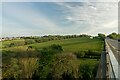
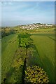
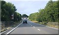
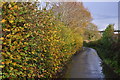
21 photos from this area
Area Information
Key information about the EX39 3RW including its size, population, and administrative classification.
- Area Type
- Postcode
- Area Size
- 1.4 hectares
- Population
- 2053
- Population Density
- 2560 people/km²
House Prices in EX39 3RW
21
Properties
£209,695
Average Sold Price
£55,500
Lowest Price
£282,500
Highest Price
Showing 21 properties
| Address | Type | Beds | Baths | Last Sale Price | Last Sale Date | |
|---|---|---|---|---|---|---|
| 10 Four Acres, Bideford, EX39 3RW | Bungalow | 2 | 1 | £282,000 | Mar 2025 | |
| Ruperts Corner, 21 Four Acres, Bideford, EX39 3RW | house | 3 | - | £282,500 | Jan 2021 | |
| 12 Four Acres, Bideford, EX39 3RW | house | - | - | £230,000 | Nov 2019 | |
| 14 Four Acres, Bideford, EX39 3RW | Bungalow | - | - | £230,000 | Jun 2018 | |
| 20 Four Acres, Bideford, EX39 3RW | Detached | 3 | 2 | £270,000 | Feb 2018 | |
| 18 Four Acres, Bideford, EX39 3RW | Detached | 2 | 1 | £250,000 | Nov 2014 | |
| 17 Four Acres, Bideford, EX39 3RW | house | 3 | - | £217,000 | Sep 2010 | |
| 19 Four Acres, Bideford, EX39 3RW | house | - | - | £190,000 | Oct 2009 | |
| 15 Four Acres, Bideford, EX39 3RW | house | 4 | 2 | £89,950 | May 1999 | |
| 11 Four Acres, Bideford, EX39 3RW | house | - | - | £55,500 | Apr 1996 |
Page 1 of 3
Energy Efficiency in EX39 3RW
Amenities
Schools
| Rank | School | Type | Entry gender | Ages |
|---|
Explore more schools in this area
Go to Schools tabDemographics
Household Size
Two person
most common
Accommodation Type
Houses
most common
Tenure
86
majority
Ethnic Group
White
most common
Religion
N/A
most common
Household Composition
N/A
most common
Age
47
median
Adults (30-64 years)
most common
Household Deprivation
N/A
with no deprivation
NS-SEC
31
in Lower managerial occupations
Explore more demographic insights in this area
Go to Demographics tabPlanning
Planning Constraints
- Flood RiskPremium
- Ramsar Wetland SitesPremium
- Area of Outstanding Natural BeautyPremium
- Protected Nature ReservePremium
- Protected WoodlandPremium