Area Overview for EX39 1EH
Photos of EX39 1EH
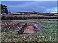
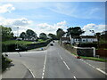
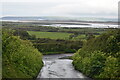
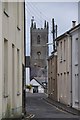
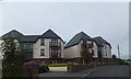
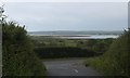
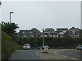

22 photos from this area
Area Information
Key information about the EX39 1EH including its size, population, and administrative classification.
- Area Type
- Postcode
- Area Size
- 1.5 hectares
- Population
- 1491
- Population Density
- 5438 people/km²
House Prices in EX39 1EH
27
Properties
£219,986
Average Sold Price
£49,500
Lowest Price
£410,000
Highest Price
Showing 27 properties
| Address | Type | Beds | Baths | Last Sale Price | Last Sale Date | |
|---|---|---|---|---|---|---|
| 2 Lily Close, Northam, EX39 1EH | Bungalow | 2 | 1 | £282,000 | Jul 2025 | |
| 41 Lily Close, Northam, EX39 1EH | Detached | 4 | 2 | £360,000 | Mar 2025 | |
| 9 Lily Close, Northam, EX39 1EH | Bungalow | 3 | - | £286,000 | Dec 2024 | |
| Rose End, Lily Close, Northam, EX39 1EH | house | - | - | £325,000 | Feb 2023 | |
| 3 Lily Close, Northam, EX39 1EH | Bungalow | - | - | £227,000 | Dec 2022 | |
| 29 Lily Close, Northam, EX39 1EH | Bungalow | 3 | 2 | £410,000 | Sep 2022 | |
| 11 Lily Close, Northam, EX39 1EH | Bungalow | - | - | £225,000 | Jul 2021 | |
| 7 Lily Close, Northam, EX39 1EH | Bungalow | - | - | £220,000 | Apr 2020 | |
| 37 Lily Close, Northam, EX39 1EH | Detached | 4 | 2 | £295,000 | Apr 2019 | |
| 35 Lily Close, Northam, EX39 1EH | Bungalow | 3 | 1 | £245,000 | Mar 2019 |
Page 1 of 3
Energy Efficiency in EX39 1EH
Amenities
Schools
| Rank | School | Type | Entry gender | Ages |
|---|
Explore more schools in this area
Go to Schools tabDemographics
Household Size
One person
most common
Accommodation Type
Houses
most common
Tenure
55
majority
Ethnic Group
White
most common
Religion
N/A
most common
Household Composition
N/A
most common
Age
47
median
Adults (30-64 years)
most common
Household Deprivation
N/A
with no deprivation
NS-SEC
25
in Lower managerial occupations
Explore more demographic insights in this area
Go to Demographics tabPlanning
Planning Constraints
- Flood RiskPremium
- Ramsar Wetland SitesPremium
- Area of Outstanding Natural BeautyPremium
- Protected Nature ReservePremium
- Protected WoodlandPremium