Area Overview for EX39 1AT
Photos of EX39 1AT


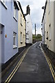
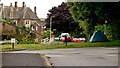
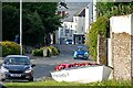

34 photos from this area
Area Information
Key information about the EX39 1AT including its size, population, and administrative classification.
- Area Type
- Postcode
- Area Size
- 5327 m²
- Population
- 1491
- Population Density
- 5438 people/km²
House Prices in EX39 1AT
28
Properties
£165,679
Average Sold Price
£86,500
Lowest Price
£320,000
Highest Price
Showing 28 properties
| Address | Type | Beds | Baths | Last Sale Price | Last Sale Date | |
|---|---|---|---|---|---|---|
| 9 Castle Street, Northam, EX39 1AT | Terraced | 2 | 1 | £225,000 | Feb 2025 | |
| 1 Castle Street, Northam, EX39 1AT | Terraced | 2 | 1 | £195,000 | Jan 2025 | |
| 20 Castle Street, Northam, EX39 1AT | Terraced | 3 | 2 | £248,000 | Dec 2023 | |
| 12 Castle Street, Northam, EX39 1AT | Terraced | 2 | 1 | £110,500 | Feb 2023 | |
| 22 CASTLE STREET, Northam, EX39 1AT | Detached | 2 | 1 | £255,000 | Nov 2022 | |
| 23 Castle Street, Northam, EX39 1AT | Terraced | 2 | 1 | £320,000 | Oct 2022 | |
| 5 Castle Street, Northam, EX39 1AT | Terraced | 2 | 1 | £220,000 | Oct 2022 | |
| 13 Castle Street, Northam, EX39 1AT | Detached | 3 | 1 | £182,000 | Jul 2019 | |
| 3 Castle Street, Northam, EX39 1AT | Terraced | 2 | 1 | £120,000 | May 2019 | |
| 2 Castle Street, Northam, EX39 1AT | Terraced | 2 | 1 | £130,000 | Dec 2017 |
Page 1 of 3
Energy Efficiency in EX39 1AT
Amenities
Schools
| Rank | School | Type | Entry gender | Ages |
|---|
Explore more schools in this area
Go to Schools tabDemographics
Household Size
One person
most common
Accommodation Type
Houses
most common
Tenure
55
majority
Ethnic Group
White
most common
Religion
N/A
most common
Household Composition
N/A
most common
Age
47
median
Adults (30-64 years)
most common
Household Deprivation
N/A
with no deprivation
NS-SEC
25
in Lower managerial occupations
Explore more demographic insights in this area
Go to Demographics tabPlanning
Planning Constraints
- Flood RiskPremium
- Ramsar Wetland SitesPremium
- Area of Outstanding Natural BeautyPremium
- Protected Nature ReservePremium
- Protected WoodlandPremium