Area Overview for EX38 8DN
Photos of EX38 8DN
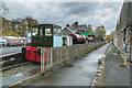
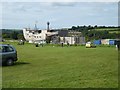
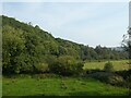
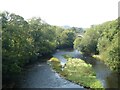
42 photos from this area
Area Information
Key information about the EX38 8DN including its size, population, and administrative classification.
- Area Type
- Postcode
- Area Size
- 3.7 hectares
- Population
- 1684
- Population Density
- 1619 people/km²
House Prices in EX38 8DN
30
Properties
£295,000
Average Sold Price
£255,000
Lowest Price
£335,000
Highest Price
Showing 30 properties
| Address | Type | Beds | Baths | Last Sale Price | Last Sale Date | |
|---|---|---|---|---|---|---|
| Westover, Torridge View, Torrington, EX38 8DN | Bungalow | - | - | £255,000 | Aug 2016 | |
| Fairlight, Torridge View, Torrington, EX38 8DN | Bungalow | 3 | 2 | £335,000 | Dec 2012 | |
| Former 1, Cromlech House, Torridge View, Torrington, EX38 8DN | Unknown | - | - | - | - | |
| Former 2, Cromlech House, Torridge View, Torrington, EX38 8DN | Unknown | - | - | - | - | |
| Former 3, Cromlech House, Torridge View, Torrington, EX38 8DN | Unknown | - | - | - | - | |
| Former 4, Cromlech House, Torridge View, Torrington, EX38 8DN | Unknown | - | - | - | - | |
| Former 5, Cromlech House, Torridge View, Torrington, EX38 8DN | Unknown | - | - | - | - | |
| Whinbrae, Torridge View, Torrington, EX38 8DN | Detached | - | - | - | - | |
| Colinette, Torridge View, Torrington, EX38 8DN | Detached | - | - | - | - | |
| 6 Torridge View, Torrington, EX38 8DN | Bungalow | - | - | - | - |
Page 1 of 3
Energy Efficiency in EX38 8DN
Amenities
Schools
| Rank | School | Type | Entry gender | Ages |
|---|
Explore more schools in this area
Go to Schools tabDemographics
Household Size
Two person
most common
Accommodation Type
Houses
most common
Tenure
66
majority
Ethnic Group
White
most common
Religion
N/A
most common
Household Composition
N/A
most common
Age
47
median
Adults (30-64 years)
most common
Household Deprivation
N/A
with no deprivation
NS-SEC
29
in Lower managerial occupations
Explore more demographic insights in this area
Go to Demographics tabPlanning
Planning Constraints
- Flood RiskPremium
- Ramsar Wetland SitesPremium
- Area of Outstanding Natural BeautyPremium
- Protected Nature ReservePremium
- Protected WoodlandPremium