Area Overview for EX38 7HQ
Photos of EX38 7HQ
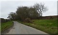
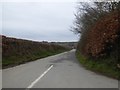
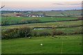
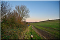
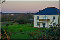
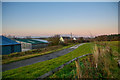

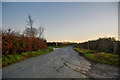
18 photos from this area
Area Information
Key information about the EX38 7HQ including its size, population, and administrative classification.
- Area Type
- Postcode
- Area Size
- 1.6 km²
- Population
- 1634
- Population Density
- 55 people/km²
House Prices in EX38 7HQ
17
Properties
£858,500
Average Sold Price
£810,000
Lowest Price
£907,000
Highest Price
Showing 17 properties
| Address | Type | Beds | Baths | Last Sale Price | Last Sale Date | |
|---|---|---|---|---|---|---|
| Twitchen Farm Cottage, Road To Twitchen Farm, Huntshaw, EX38 7HQ | Land | - | - | £810,000 | Feb 2023 | |
| Potato House, Road To Twitchen Farm, Huntshaw, EX38 7HQ | house | - | - | £907,000 | Sep 2007 | |
| 2, Sheddymoor Heights, Road From Twitchen Cross To Huntshaw Cross, Huntshaw, EX38 7HQ | Semi-detached | 3 | 1 | - | - | |
| Lower Huntshaw Barton, Road From Twitchen Cross To Huntshaw Cross, Huntshaw, EX38 7HQ | Land | 3 | - | - | - | |
| Twitchen Farm, Road To Twitchen Farm, Huntshaw, EX38 7HQ | Farm | 10 | 1 | - | - | |
| Lower Twitchen Farm, Road To Twitchen Farm, Huntshaw, EX38 7HQ | Land | - | - | - | - | |
| 1, Sheddymoor Heights, Road From Twitchen Cross To Huntshaw Cross, Huntshaw, EX38 7HQ | Land | - | - | - | - | |
| Willow Cottage Mobile Home, Road To Twitchen Farm, Huntshaw, EX38 7HQ | Mobile Home | - | - | - | - | |
| Wind Turbine At Grid Reference 252301 123721, Road To Hill Farm, Huntshaw, EX38 7HQ | Industrial | - | - | - | - | |
| Sand School At Grid Reference 252415 123370, Road To Twitchen Farm, Huntshaw, EX38 7HQ | Equestrian | - | - | - | - |
Page 1 of 2
Energy Efficiency in EX38 7HQ
Amenities
Schools
| Rank | School | Type | Entry gender | Ages |
|---|
Explore more schools in this area
Go to Schools tabDemographics
Household Size
Two person
most common
Accommodation Type
Houses
most common
Tenure
80
majority
Ethnic Group
White
most common
Religion
N/A
most common
Household Composition
N/A
most common
Age
47
median
Adults (30-64 years)
most common
Household Deprivation
N/A
with no deprivation
NS-SEC
28
in Lower managerial occupations
Explore more demographic insights in this area
Go to Demographics tabPlanning
Planning Constraints
- Flood RiskPremium
- Ramsar Wetland SitesPremium
- Area of Outstanding Natural BeautyPremium
- Protected Nature ReservePremium
- Protected WoodlandPremium