Area Overview for EX36 4QD
Photos of EX36 4QD


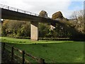
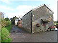
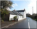
32 photos from this area
Area Information
Key information about the EX36 4QD including its size, population, and administrative classification.
- Area Type
- Postcode
- Area Size
- 1.4 km²
- Population
- 2558
- Population Density
- 29 people/km²
House Prices in EX36 4QD
22
Properties
£372,167
Average Sold Price
£60,000
Lowest Price
£710,000
Highest Price
Showing 22 properties
| Address | Type | Beds | Baths | Last Sale Price | Last Sale Date | |
|---|---|---|---|---|---|---|
| Oakmoor Cottage, Road From Cott Cross To Ford Cross, Ash Mill, EX36 4QD | house | 4 | - | £710,000 | Nov 2023 | |
| Woodhills Farm, Road Past Woods House, Ash Mill, EX36 4QD | house | - | - | £200,000 | Nov 2020 | |
| Rock Cottage, Road From Cott Cross To Ford Cross, Ash Mill, EX36 4QD | Detached | 6 | 2 | £340,000 | Nov 2015 | |
| Cott Cross, Road From Cott Cross To West Cross Side, Ash Mill, EX36 4QD | Bungalow | 4 | - | £348,000 | Jul 2012 | |
| Rodsworthy Farm House, Road From Wicaford Cross To Cott Cross, Bishops Nympton, EX36 4QD | house | - | - | £575,000 | Nov 2005 | |
| Homeleigh, Road From Cott Cross To Ford Cross, Ash Mill, EX36 4QD | house | 2 | 1 | £60,000 | Jul 1998 | |
| The Bungalow, Road From Wicaford Cross To Cott Cross, Bishops Nympton, EX36 4QD | Detached | 5 | 3 | - | - | |
| The Mill, Road From Cott Cross To West Cross Side, Ash Mill, EX36 4QD | Detached | 4 | 3 | - | - | |
| 1, Four Winds, Road From Cott Cross To Ford Cross, Ash Mill, EX36 4QD | Cottage | 4 | 2 | - | - | |
| Rodsworthy Farm, Road From Wicaford Cross To Cott Cross, Bishops Nympton, EX36 4QD | Detached | 5 | 2 | - | - |
Page 1 of 3
Energy Efficiency in EX36 4QD
Amenities
Schools
| Rank | School | Type | Entry gender | Ages |
|---|
Explore more schools in this area
Go to Schools tabDemographics
Household Size
Two person
most common
Accommodation Type
Houses
most common
Tenure
76
majority
Ethnic Group
White
most common
Religion
N/A
most common
Household Composition
N/A
most common
Age
47
median
Adults (30-64 years)
most common
Household Deprivation
N/A
with no deprivation
NS-SEC
29
in Lower managerial occupations
Explore more demographic insights in this area
Go to Demographics tabPlanning
Planning Constraints
- Flood RiskPremium
- Ramsar Wetland SitesPremium
- Area of Outstanding Natural BeautyPremium
- Protected Nature ReservePremium
- Protected WoodlandPremium