Area Overview for EX36 4ER
Photos of EX36 4ER

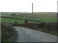

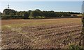
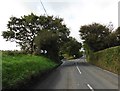


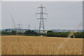


17 photos from this area
Area Information
Key information about the EX36 4ER including its size, population, and administrative classification.
- Area Type
- Postcode
- Area Size
- 30.8 hectares
- Population
- 2465
- Population Density
- 162 people/km²
House Prices in EX36 4ER
21
Properties
£238,250
Average Sold Price
£35,500
Lowest Price
£525,000
Highest Price
Showing 21 properties
| Address | Type | Beds | Baths | Last Sale Price | Last Sale Date | |
|---|---|---|---|---|---|---|
| Meadow View, George Nympton Road, South Molton, EX36 4ER | Bungalow | 3 | 1 | £315,000 | Jun 2025 | |
| Beechleigh, George Nympton Road, South Molton, EX36 4ER | Detached | 4 | 3 | £525,000 | Feb 2025 | |
| 4 Buckingham Close, South Molton, EX36 4ER | Bungalow | 2 | 1 | £330,000 | Feb 2023 | |
| Taranaki, George Nympton Road, South Molton, EX36 4ER | Detached | - | - | £240,000 | Dec 2016 | |
| Buckingham Gate, George Nympton Road, South Molton, EX36 4ER | Bungalow | - | - | £295,000 | Mar 2016 | |
| Conestoga, George Nympton Road, South Molton, EX36 4ER | Bungalow | 3 | 2 | £295,000 | Nov 2015 | |
| Grey Hollow, George Nympton Road, South Molton, EX36 4ER | Detached | 6 | 3 | £367,500 | Nov 2015 | |
| Mole Cottage, George Nympton Road, South Molton, EX36 4ER | Bungalow | 3 | - | £275,000 | Aug 2013 | |
| Andante, George Nympton Road, South Molton, EX36 4ER | house | - | - | £155,000 | Apr 2005 | |
| Crossland, Buckingham Close, South Molton, EX36 4ER | Detached | - | - | £220,000 | Dec 2004 |
Page 1 of 3
Energy Efficiency in EX36 4ER
Amenities
Schools
| Rank | School | Type | Entry gender | Ages |
|---|
Explore more schools in this area
Go to Schools tabDemographics
Household Size
Two person
most common
Accommodation Type
Houses
most common
Tenure
72
majority
Ethnic Group
White
most common
Religion
N/A
most common
Household Composition
N/A
most common
Age
47
median
Adults (30-64 years)
most common
Household Deprivation
N/A
with no deprivation
NS-SEC
29
in Lower managerial occupations
Explore more demographic insights in this area
Go to Demographics tabPlanning
Planning Constraints
- Flood RiskPremium
- Ramsar Wetland SitesPremium
- Area of Outstanding Natural BeautyPremium
- Protected Nature ReservePremium
- Protected WoodlandPremium