Area Overview for EX36 4AG
Photos of EX36 4AG
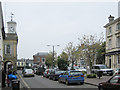
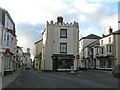
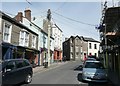
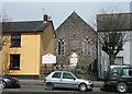
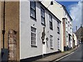

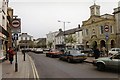

100 photos from this area
Area Information
Key information about the EX36 4AG including its size, population, and administrative classification.
- Area Type
- Postcode
- Area Size
- 9797 m²
- Population
- 1950
- Population Density
- 3030 people/km²
House Prices in EX36 4AG
51
Properties
£130,039
Average Sold Price
£33,750
Lowest Price
£260,000
Highest Price
Showing 51 properties
| Address | Type | Beds | Baths | Last Sale Price | Last Sale Date | |
|---|---|---|---|---|---|---|
| 68 South Street, South Molton, EX36 4AG | house | - | - | £240,000 | Aug 2021 | |
| The Garden Flat, 77B South Street, South Molton, EX36 4AG | Bungalow | 1 | 1 | £65,000 | Aug 2020 | |
| 79A South Street, South Molton, EX36 4AG | Bungalow | 1 | 1 | £110,000 | Dec 2018 | |
| 71 South Street, South Molton, EX36 4AG | Semi-detached | 3 | 1 | £185,000 | Oct 2018 | |
| 70 South Street, South Molton, EX36 4AG | Terraced | 5 | - | £260,000 | Sep 2016 | |
| 65 South Street, South Molton, EX36 4AG | Terraced | 4 | 1 | £185,500 | Sep 2014 | |
| 69 South Street, South Molton, EX36 4AG | house | 5 | 2 | £195,000 | Jun 2014 | |
| 58A South Street, South Molton, EX36 4AG | house | - | - | £110,000 | Dec 2013 | |
| 63 South Street, South Molton, EX36 4AG | Terraced | 3 | - | £100,000 | Mar 2010 | |
| 67 South Street, South Molton, EX36 4AG | Terraced | - | - | £225,000 | Feb 2007 |
Page 1 of 6
Energy Efficiency in EX36 4AG
Amenities
Schools
| Rank | School | Type | Entry gender | Ages |
|---|
Explore more schools in this area
Go to Schools tabDemographics
Household Size
One person
most common
Accommodation Type
Houses
most common
Tenure
60
majority
Ethnic Group
White
most common
Religion
N/A
most common
Household Composition
N/A
most common
Age
47
median
Adults (30-64 years)
most common
Household Deprivation
N/A
with no deprivation
NS-SEC
26
in Lower managerial occupations
Explore more demographic insights in this area
Go to Demographics tabPlanning
Planning Constraints
- Flood RiskPremium
- Ramsar Wetland SitesPremium
- Area of Outstanding Natural BeautyPremium
- Protected Nature ReservePremium
- Protected WoodlandPremium