Area Overview for EX36 3ND
Photos of EX36 3ND
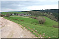

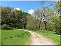

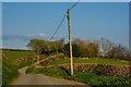

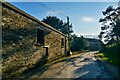
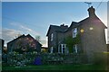
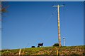


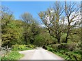
15 photos from this area
Area Information
Key information about the EX36 3ND including its size, population, and administrative classification.
- Area Type
- Postcode
- Area Size
- 2.0 km²
- Population
- 2327
- Population Density
- 17 people/km²
House Prices in EX36 3ND
31
Properties
£189,400
Average Sold Price
£69,000
Lowest Price
£332,000
Highest Price
Showing 31 properties
| Address | Type | Beds | Baths | Last Sale Price | Last Sale Date | |
|---|---|---|---|---|---|---|
| Meadows End, 1 Meadow Park, Molland, EX36 3ND | house | - | - | £332,000 | Sep 2021 | |
| 7 Meadow Park, Molland, EX36 3ND | Terraced | 3 | 1 | £176,000 | Jun 2018 | |
| 9 Meadow Park, Molland, EX36 3ND | Semi-detached | 3 | 1 | £225,000 | Feb 2017 | |
| Honeysuckle Cottage, 12 Meadow Park, Molland, EX36 3ND | Semi-detached | - | - | £145,000 | Aug 2012 | |
| 5 Meadow Park, Molland, EX36 3ND | Terraced | - | - | £69,000 | May 2000 | |
| 4, Higher Rock Cottages, Road From Bickingcott Cross To The Manor House, Molland, EX36 3ND | undefined | - | - | - | - | |
| 3, Higher Rock Cottages, Road From Bickingcott Cross To The Manor House, Molland, EX36 3ND | undefined | - | - | - | - | |
| Great Champson Farm, Lane From Great Woods Farm To Great Champson Farm, Molland, EX36 3ND | house | - | - | - | - | |
| 8 Meadow Park, Molland, EX36 3ND | house | - | - | - | - | |
| Lower Hill Farm, Lane From Great Woods Farm To Great Champson Farm, Molland, EX36 3ND | house | - | - | - | - |
Page 1 of 4
Energy Efficiency in EX36 3ND
Amenities
Schools
| Rank | School | Type | Entry gender | Ages |
|---|
Explore more schools in this area
Go to Schools tabDemographics
Household Size
Two person
most common
Accommodation Type
Houses
most common
Tenure
66
majority
Ethnic Group
White
most common
Religion
N/A
most common
Household Composition
N/A
most common
Age
47
median
Adults (30-64 years)
most common
Household Deprivation
N/A
with no deprivation
NS-SEC
28
in Lower managerial occupations
Explore more demographic insights in this area
Go to Demographics tabPlanning
Planning Constraints
- Flood RiskPremium
- Ramsar Wetland SitesPremium
- Area of Outstanding Natural BeautyPremium
- Protected Nature ReservePremium
- Protected WoodlandPremium