Area Overview for EX35 6EP
Photos of EX35 6EP

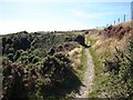
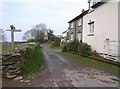
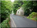
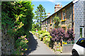
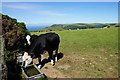
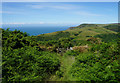
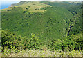
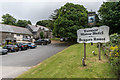
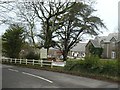
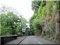
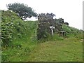
21 photos from this area
Area Information
Key information about the EX35 6EP including its size, population, and administrative classification.
- Area Type
- Postcode
- Area Size
- 52.0 hectares
- Population
- 1608
- Population Density
- 24 people/km²
House Prices in EX35 6EP
41
Properties
£256,121
Average Sold Price
£47,950
Lowest Price
£800,000
Highest Price
Showing 41 properties
| Address | Type | Beds | Baths | Last Sale Price | Last Sale Date | |
|---|---|---|---|---|---|---|
| 21 Watersmeet Road, Lynmouth, EX35 6EP | house | 3 | 2 | £315,000 | Oct 2022 | |
| 21A Watersmeet Road, Lynmouth, EX35 6EP | Terraced | 6 | 6 | £210,000 | Sep 2022 | |
| The Old School House, 27 Watersmeet Road, Lynmouth, EX35 6EP | house | 1 | 1 | £800,000 | Aug 2022 | |
| 9 Watersmeet Road, Lynmouth, EX35 6EP | Terraced | - | - | £275,000 | Nov 2021 | |
| 24 Watersmeet Road, Lynmouth, EX35 6EP | house | 3 | 1 | £265,000 | Nov 2020 | |
| 28 Watersmeet Road, Lynmouth, EX35 6EP | Flat | - | - | £115,000 | Jul 2019 | |
| 23 Watersmeet Road, Lynmouth, EX35 6EP | house | 2 | 1 | £285,000 | Oct 2015 | |
| 7 Watersmeet Road, Lynmouth, EX35 6EP | Terraced | - | - | £240,000 | Jun 2015 | |
| COBBLERS COTTAGE, 36 WATERSMEET ROAD, Lynmouth, EX35 6EP | Detached | - | - | £123,500 | Mar 2014 | |
| 5A Watersmeet Road, Lynmouth, EX35 6EP | Flat | - | - | £285,000 | Oct 2012 |
Page 1 of 5
Energy Efficiency in EX35 6EP
Amenities
Schools
| Rank | School | Type | Entry gender | Ages |
|---|
Explore more schools in this area
Go to Schools tabDemographics
Household Size
Two person
most common
Accommodation Type
Houses
most common
Tenure
69
majority
Ethnic Group
White
most common
Religion
N/A
most common
Household Composition
N/A
most common
Age
47
median
Adults (30-64 years)
most common
Household Deprivation
N/A
with no deprivation
NS-SEC
27
in Lower managerial occupations
Explore more demographic insights in this area
Go to Demographics tabPlanning
Planning Constraints
- Flood RiskPremium
- Ramsar Wetland SitesPremium
- Area of Outstanding Natural BeautyPremium
- Protected Nature ReservePremium
- Protected WoodlandPremium