Area Overview for EX35 6AJ
Photos of EX35 6AJ

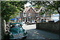


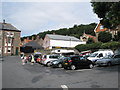
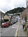
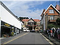
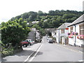
100 photos from this area
Area Information
Key information about the EX35 6AJ including its size, population, and administrative classification.
- Area Type
- Postcode
- Area Size
- 2066 m²
- Population
- 1608
- Population Density
- 24 people/km²
House Prices in EX35 6AJ
15
Properties
£203,125
Average Sold Price
£90,000
Lowest Price
£341,750
Highest Price
Showing 15 properties
| Address | Type | Beds | Baths | Last Sale Price | Last Sale Date | |
|---|---|---|---|---|---|---|
| The Old Laundry, Lydiate Lane, Lynton, EX35 6AJ | Detached | - | - | £105,000 | Feb 2021 | |
| Waterloo Lodge, Lydiate Lane, Lynton, EX35 6AJ | Semi-detached | - | - | £341,750 | May 2019 | |
| 1, Abbey Court, Lydiate Lane, Lynton, EX35 6AJ | house | 2 | 1 | £123,500 | Sep 2018 | |
| Zephyr Cottage, Lydiate Lane, Lynton, EX35 6AJ | Terraced | - | - | £330,000 | Apr 2018 | |
| 3, Abbey Court, Lydiate Lane, Lynton, EX35 6AJ | house | 3 | 1 | £142,500 | May 2015 | |
| 4, Abbey Court, Lydiate Lane, Lynton, EX35 6AJ | house | 3 | 1 | £212,500 | Sep 2014 | |
| 6, Abbey Court, Lydiate Lane, Lynton, EX35 6AJ | house | 3 | 1 | £222,500 | May 2014 | |
| 5, Abbey Court, Lydiate Lane, Lynton, EX35 6AJ | house | 3 | 1 | £223,500 | Aug 2013 | |
| Saffron Cottage, Lydiate Lane, Lynton, EX35 6AJ | house | - | - | £90,000 | Mar 2010 | |
| Little Zephyr, Lydiate Lane, Lynton, EX35 6AJ | Flat | - | - | £240,000 | Nov 2006 |
Page 1 of 2
Energy Efficiency in EX35 6AJ
Amenities
Schools
| Rank | School | Type | Entry gender | Ages |
|---|
Explore more schools in this area
Go to Schools tabDemographics
Household Size
Two person
most common
Accommodation Type
Houses
most common
Tenure
69
majority
Ethnic Group
White
most common
Religion
N/A
most common
Household Composition
N/A
most common
Age
47
median
Adults (30-64 years)
most common
Household Deprivation
N/A
with no deprivation
NS-SEC
27
in Lower managerial occupations
Explore more demographic insights in this area
Go to Demographics tabPlanning
Planning Constraints
- Flood RiskPremium
- Ramsar Wetland SitesPremium
- Area of Outstanding Natural BeautyPremium
- Protected Nature ReservePremium
- Protected WoodlandPremium