Area Overview for EX34 9AL
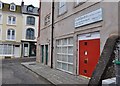
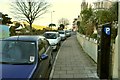
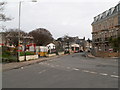
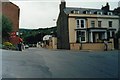
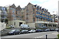
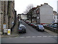
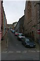
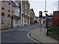
Photos of EX34 9AL


Area Information
Living in EX34 9AL means inhabiting a compact residential cluster in England, where 1,473 people reside across 1,369 square metres. This postcode area is densely populated, with over 1 million people per square kilometre, reflecting a tight-knit community. The area’s small size means proximity to local amenities and services is key. Residents are likely to find daily life shaped by nearby retail outlets, the Ilfracombe Ferry Landing, and the surrounding natural landscape. While the area lacks large-scale infrastructure, its compact nature ensures convenience for those prioritising accessibility over expansive space. The presence of a primary school with a good Ofsted rating suggests a focus on family-oriented living, though the area’s demographics—predominantly adults aged 30–64—indicate a mature, stable population. For buyers, EX34 9AL offers a snapshot of a specific, well-defined locale, where every home is within reach of essential services and the broader regional context.
- Area Type
- Postcode
- Area Size
- 1369 m²
- Population
- 1473
- Population Density
- 6228 people/km²
The property market in EX34 9AL is characterised by a low home ownership rate of 36%, indicating that the majority of housing stock is rented rather than owned. Flats dominate the accommodation type, which is typical for densely populated areas with limited space. This suggests a focus on smaller, shared living arrangements rather than larger family homes. For buyers, the small area size and high density mean limited options, with properties likely to be part of a larger residential cluster. The prevalence of flats may appeal to those seeking affordability or proximity to local amenities, but the low ownership rate could signal a reliance on rental markets. Prospective buyers should consider the area’s compact nature and the potential for limited long-term investment in property value, given the lack of expansive development or unique features.
House Prices in EX34 9AL
No properties found in this postcode.
Energy Efficiency in EX34 9AL
Residents of EX34 9AL have access to five retail outlets, including Morrisons, Lidl, and Co-op, providing essential shopping options within practical reach. The Ilfracombe Ferry Landing adds a unique element to daily life, offering transportation across waterways and potentially linking to nearby coastal or rural areas. While the area lacks large parks or leisure facilities, the proximity to the ferry suggests opportunities for outdoor activities or commuting to larger recreational zones. The retail mix caters to basic needs, but those seeking extensive shopping or dining options may need to travel further. The compact nature of the area means amenities are concentrated, creating a self-contained lifestyle for those prioritising convenience over variety.
Amenities
Schools
The nearest school to EX34 9AL is the Ilfracombe Church of England Junior School, a primary institution with a good Ofsted rating. This school serves the local community, offering education for younger children in a setting that aligns with the area’s family-oriented profile. The presence of a primary school with a positive rating is a key consideration for families prioritising quality education. However, the absence of secondary schools or additional educational institutions within the data means that students may need to travel further for higher-level schooling. The school’s rating suggests a reliable standard of teaching, but the overall educational infrastructure for the area remains focused on primary education, requiring families to plan for secondary schooling elsewhere.
| Rank | School | Type | Entry gender | Ages |
|---|
Explore more schools in this area
Go to Schools tabDemographics
The population of EX34 9AL is 1,473, with a median age of 47, indicating a mature demographic skewed towards adults aged 30–64. Home ownership here is relatively low at 36%, suggesting a higher proportion of renters compared to owner-occupied properties. The predominant accommodation type is flats, which aligns with the area’s density and compact footprint. The majority of residents identify as White, reflecting a homogenous ethnic composition. This age group and housing type suggest a community of established individuals, possibly retired or in later career stages, with limited family households. The absence of specific deprivation data means quality of life is inferred from the availability of local amenities and services. The high population density, however, may impact living conditions, particularly in shared or multi-unit housing.
Household Size
Accommodation Type
Tenure
Ethnic Group
Religion
Household Composition
Age
Household Deprivation
NS-SEC
Explore more demographic insights in this area
Go to Demographics tabPlanning
Planning Constraints
- Flood RiskPremium
- Ramsar Wetland SitesPremium
- Area of Outstanding Natural BeautyPremium
- Protected Nature ReservePremium
- Protected WoodlandPremium