Area Overview for EX34 9AH
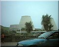
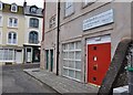
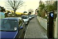
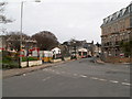
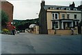
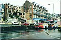
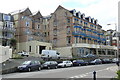
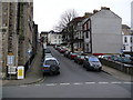
Photos of EX34 9AH

Area Information
Living in EX34 9AH means inhabiting a small, densely populated residential cluster in England. The area covers 3,844 square metres and is home to 1,404 residents, translating to a population density of 365,216 people per square kilometre. This compact postcode is defined by its proximity to Ilfracombe, a coastal town with a ferry terminal and retail hubs. The community is predominantly middle-aged, with a median age of 47, and the majority of residents are adults aged 30–64. Daily life here is shaped by the area’s limited space and reliance on nearby amenities. While the postcode lacks natural landscapes or protected sites, its location near Ilfracombe offers access to coastal routes and local shopping. The high population density means the area feels tightly knit, though the small size also means limited housing diversity. For those seeking a quiet, compact living space with easy access to nearby towns, EX34 9AH offers a distinct, if constrained, lifestyle.
- Area Type
- Postcode
- Area Size
- 3844 m²
- Population
- 1404
- Population Density
- 1701 people/km²
The property market in EX34 9AH is characterised by a 50% home ownership rate, meaning half the properties are rented out. The accommodation type is almost exclusively flats, which aligns with the area’s small footprint and high density. This suggests a housing stock tailored to compact, multi-unit living rather than detached homes. For buyers, this implies limited availability of larger properties and a focus on flats, which may appeal to those seeking affordability in a tightly packed area. The small size of EX34 9AH means the immediate surroundings are likely to mirror this pattern, with little variation in property types. Buyers should consider the high population density when evaluating long-term value, as competition for space may be intense. The area’s proximity to Ilfracombe could also influence property demand, though no specific data on price trends is available.
House Prices in EX34 9AH
Showing 3 properties
| Address | Type | Beds | Baths | Last Sale Price | Last Sale Date | |
|---|---|---|---|---|---|---|
| Dilkhusa Grand Hotel, Wilder Road, Ilfracombe, EX34 9AH | hotel | - | - | - | - | |
| Staff Accommodation, Dilkhusa Grand Hotel, Wilder Road, Ilfracombe, EX34 9AH | Detached | - | - | - | - | |
| Managers, Dilkhusa Grand Hotel, Wilder Road, Ilfracombe, EX34 9AH | Flat | - | - | - | - |
Energy Efficiency in EX34 9AH
Residents of EX34 9AH have access to a handful of practical amenities within walking or short driving distance. The retail sector includes Morrisons Daily Ilfracombe 26, Lidl Ilfracombe, and Co-op Ilfracombe, providing basic grocery and household needs. The Ilfracombe Ferry Landing serves as a key transport hub, connecting the area to coastal destinations and nearby towns. While the postcode itself lacks parks or leisure facilities, the proximity to Ilfracombe may offer additional options. The small size of EX34 9AH means daily life revolves around these limited amenities, with convenience prioritised over variety. The presence of multiple supermarkets and a ferry terminal suggests a focus on functional living, though the absence of larger leisure or recreational spaces may limit options for those seeking more expansive activities.
Amenities
Schools
| Rank | School | Type | Entry gender | Ages |
|---|
Explore more schools in this area
Go to Schools tabDemographics
The community in EX34 9AH is predominantly middle-aged, with a median age of 47 and the most common age range being adults aged 30–64. This suggests a population of working professionals and families in their prime earning years. Home ownership sits at 50%, indicating a balanced mix of owner-occupied and rental properties. The accommodation type is primarily flats, reflecting the area’s compact nature and high density. The predominant ethnic group is White, with no data provided on other demographics. The population density of 365,216 people per square kilometre is exceptionally high, which may impact living conditions and community dynamics. This density, combined with the age profile, suggests a stable but mature population with established routines. However, the lack of diversity data means the full picture of social composition remains incomplete.
Household Size
Accommodation Type
Tenure
Ethnic Group
Religion
Household Composition
Age
Household Deprivation
NS-SEC
Explore more demographic insights in this area
Go to Demographics tabPlanning
Planning Constraints
- Flood RiskPremium
- Ramsar Wetland SitesPremium
- Area of Outstanding Natural BeautyPremium
- Protected Nature ReservePremium
- Protected WoodlandPremium