Area Overview for EX34 7DS
Photos of EX34 7DS

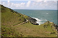
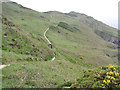
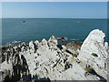
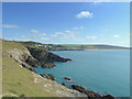


52 photos from this area
Area Information
Key information about the EX34 7DS including its size, population, and administrative classification.
- Area Type
- Postcode
- Area Size
- 67.4 hectares
- Population
- 2037
- Population Density
- 64 people/km²
House Prices in EX34 7DS
15
Properties
£425,000
Average Sold Price
£365,000
Lowest Price
£485,000
Highest Price
Showing 15 properties
| Address | Type | Beds | Baths | Last Sale Price | Last Sale Date | |
|---|---|---|---|---|---|---|
| Meadow Croft, Access To Rowcliffe, Mortehoe, EX34 7DS | Bungalow | - | - | £485,000 | May 2019 | |
| Samphire Cottage, Road From Rockleigh House To Silverthorn, Mortehoe, EX34 7DS | Detached | - | - | £365,000 | Apr 2017 | |
| Driftwood, Lane To Headland Court, Mortehoe, EX34 7DS | undefined | - | - | - | - | |
| Flat 3, Rowcliffe, Access To Rowcliffe, Mortehoe, EX34 7DS | hotel | - | - | - | - | |
| Flat 2, Rowcliffe, Access To Rowcliffe, Mortehoe, EX34 7DS | hotel | - | - | - | - | |
| Barn Close, Road From Rockleigh House To Silverthorn, Mortehoe, EX34 7DS | Detached | - | - | - | - | |
| Rowcliffe, Access To Rowcliffe, Mortehoe, EX34 7DS | Flat | - | - | - | - | |
| Silverthorne, Road From Rockleigh House To Silverthorn, Mortehoe, EX34 7DS | Bungalow | 2 | 1 | - | - | |
| 2, Sam Weller Bungalows, Access To Rowcliffe, Mortehoe, EX34 7DS | Semi-detached | - | - | - | - | |
| Flat 4, Rowcliffe, Access To Rowcliffe, Mortehoe, EX34 7DS | hotel | - | - | - | - |
Page 1 of 2
Energy Efficiency in EX34 7DS
Amenities
Schools
| Rank | School | Type | Entry gender | Ages |
|---|
Explore more schools in this area
Go to Schools tabDemographics
Household Size
Two person
most common
Accommodation Type
Houses
most common
Tenure
77
majority
Ethnic Group
White
most common
Religion
N/A
most common
Household Composition
N/A
most common
Age
47
median
Adults (30-64 years)
most common
Household Deprivation
N/A
with no deprivation
NS-SEC
35
in Lower managerial occupations
Explore more demographic insights in this area
Go to Demographics tabPlanning
Planning Constraints
- Flood RiskPremium
- Ramsar Wetland SitesPremium
- Area of Outstanding Natural BeautyPremium
- Protected Nature ReservePremium
- Protected WoodlandPremium