Area Overview for EX34 7BB
Photos of EX34 7BB
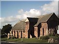
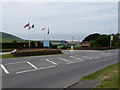
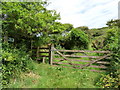
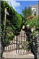

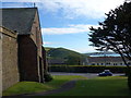
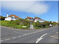
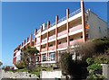
50 photos from this area
Area Information
Key information about the EX34 7BB including its size, population, and administrative classification.
- Area Type
- Postcode
- Area Size
- 1.9 hectares
- Population
- 2037
- Population Density
- 64 people/km²
House Prices in EX34 7BB
59
Properties
£316,761
Average Sold Price
£99,950
Lowest Price
£542,000
Highest Price
Showing 59 properties
| Address | Type | Beds | Baths | Last Sale Price | Last Sale Date | |
|---|---|---|---|---|---|---|
| 1, Westgate House, South Street, Woolacombe, EX34 7BB | Flat | - | - | £192,500 | Dec 2024 | |
| Fernleigh, South Street, Woolacombe, EX34 7BB | Terraced | 3 | 1 | £510,000 | Jul 2023 | |
| Ivydene, South Street, Woolacombe, EX34 7BB | Terraced | 3 | 1 | £542,000 | May 2022 | |
| Loot, South Street, Woolacombe, EX34 7BB | Flat | - | - | £181,000 | Jun 2021 | |
| Barclay House, South Street, Woolacombe, EX34 7BB | Flat | 2 | 2 | £278,000 | Jun 2021 | |
| East Denver, South Street, Woolacombe, EX34 7BB | house | 1 | 1 | £425,000 | Aug 2020 | |
| Marine View, South Street, Woolacombe, EX34 7BB | house | - | - | £375,000 | Jul 2019 | |
| 18 South Street, Woolacombe, EX34 7BB | Flat | 3 | 1 | £279,000 | Jul 2018 | |
| Flat 1, Karsue House, South Street, Woolacombe, EX34 7BB | Flat | - | - | £205,000 | May 2018 | |
| Lyndale, South Street, Woolacombe, EX34 7BB | Flat | 3 | 1 | £345,000 | Mar 2018 |
Page 1 of 6
Energy Efficiency in EX34 7BB
Amenities
Schools
| Rank | School | Type | Entry gender | Ages |
|---|
Explore more schools in this area
Go to Schools tabDemographics
Household Size
Two person
most common
Accommodation Type
Houses
most common
Tenure
77
majority
Ethnic Group
White
most common
Religion
N/A
most common
Household Composition
N/A
most common
Age
47
median
Adults (30-64 years)
most common
Household Deprivation
N/A
with no deprivation
NS-SEC
35
in Lower managerial occupations
Explore more demographic insights in this area
Go to Demographics tabPlanning
Planning Constraints
- Flood RiskPremium
- Ramsar Wetland SitesPremium
- Area of Outstanding Natural BeautyPremium
- Protected Nature ReservePremium
- Protected WoodlandPremium