Area Overview for EX34 7AH
Photos of EX34 7AH


Area Information
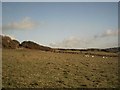
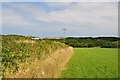
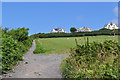
Living in EX34 7AH means being part of a small, tightly knit residential cluster in England. The area covers just 4.1 hectares, housing 2037 people at a density of 64 per square kilometre. This compact layout fosters a quiet, community-oriented environment, where daily life is shaped by proximity to local amenities. The postcode sits near the coast, with the Ilfracombe Ferry Landing offering direct access to maritime routes. Residents benefit from a balance of rural tranquillity and practical connectivity, with nearby shops and schools within walking distance. The area’s character is defined by its modest scale and the presence of natural beauty, as it lies within an Area of Outstanding Natural Beauty. This designation may influence development but ensures a scenic backdrop for everyday living. For those seeking a peaceful yet accessible home, EX34 7AH offers a blend of low population density and well-maintained infrastructure, making it suitable for families and individuals alike.
- Area Type
- Postcode
- Area Size
- 4.1 hectares
- Population
- 2037
- Population Density
- 64 people/km²
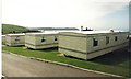
The property market in EX34 7AH is characterised by high home ownership, with 77% of residents occupying their own homes. The accommodation type is predominantly houses, indicating a lack of flats or apartments. This suggests a market skewed towards owner-occupation rather than rental properties, which may limit availability for buyers seeking to rent. The small area size of 4.1 hectares means the housing stock is limited, making the local market highly competitive for those looking to purchase. The presence of houses implies larger properties, which could be attractive to families or individuals prioritising space. However, the small footprint of the area means buyers must consider proximity to amenities and transport links, as the immediate surroundings are likely to be the primary source of additional options.
House Prices in EX34 7AH
Showing 2 properties
| Address | Type | Beds | Baths | Last Sale Price | Last Sale Date | |
|---|---|---|---|---|---|---|
| Baitball Bar And Restaurant, Woolacombe Bay Holiday Village Ltd, Lane To Woolacombe Bay Holiday Parks, Woolacombe, EX34 7AH | Restaurant | - | - | - | - | |
| Mary And Rose, Woolacombe Bay Holiday Village Ltd, Lane To Woolacombe Bay Holiday Parks, Woolacombe, EX34 7AH | Retail | - | - | - | - |
Energy Efficiency in EX34 7AH
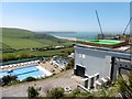
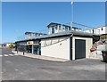
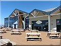
The lifestyle in EX34 7AH is shaped by its proximity to essential amenities. Within walking distance are five retail outlets, including Co-op Ilfracombe, Lidl Ilfracombe, and Morrisons Daily Ilfracombe 26, ensuring everyday shopping needs are met. The Ilfracombe Ferry Landing adds a unique dimension, offering access to coastal routes and recreational opportunities. While the area lacks large parks or leisure facilities, its inclusion in an Area of Outstanding Natural Beauty means residents can enjoy scenic landscapes nearby. The combination of local shops, the ferry, and natural surroundings creates a convenient yet tranquil lifestyle. This balance of practicality and scenery suits those who value accessibility without sacrificing the appeal of a picturesque environment.
Amenities
Schools
Residents of EX34 7AH have access to three schools within practical reach. West Down School is a primary school with an Ofsted rating of ‘good’, while Woolacombe School operates as both a primary school and an academy, also rated ‘good’ by Ofsted. These institutions provide a range of educational options for families, with the academy model potentially offering specialist curricula or governance structures. The presence of two schools rated ‘good’ suggests a reliable foundation for primary education, which is a key consideration for homebuyers with children. The mix of school types allows parents to choose between traditional state education and the potentially more flexible academy system. This diversity supports families seeking different approaches to schooling without needing to travel far.
| Rank | School | Type | Entry gender | Ages |
|---|
Explore more schools in this area
Go to Schools tabDemographics
The population of EX34 7AH is predominantly adults aged 30–64, with a median age of 47. This suggests a mature, stable community where most residents are likely to be established in their careers or retirement. Home ownership is high, at 77%, with the majority of properties being houses rather than flats. The predominant ethnic group is White, reflecting a homogenous demographic profile. The low population density of 64 people per square kilometre indicates spacious living conditions, which may appeal to those seeking privacy or larger homes. While specific data on deprivation is not provided, the high home ownership rate and age profile suggest a relatively affluent and settled population. This demographic structure supports a community focused on long-term residency, with fewer transient residents compared to more urban areas.
Household Size
Accommodation Type
Tenure
Ethnic Group
Religion
Household Composition
Age
Household Deprivation
NS-SEC
Explore more demographic insights in this area
Go to Demographics tabPlanning
Planning Constraints
- Flood RiskPremium
- Ramsar Wetland SitesPremium
- Area of Outstanding Natural BeautyPremium
- Protected Nature ReservePremium
- Protected WoodlandPremium