Area Overview for EX33 1NZ
Photos of EX33 1NZ


Area Information
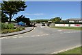
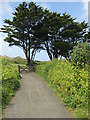
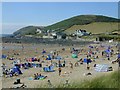
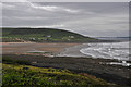
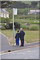
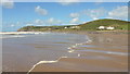
Living in EX33 1NZ means being part of a small, tightly knit residential cluster in England. The area spans 15 hectares and is home to 1,327 residents, creating a quiet, low-density environment. With a median age of 47, the community is predominantly composed of adults aged 30–64, suggesting a stable population with established roots. Daily life here is shaped by the area’s rural character, with homes primarily in traditional styles and a strong emphasis on local amenities. Proximity to natural landscapes is a defining feature, as the area lies within the Area of Outstanding Natural Beauty (AONB) designation, offering residents access to scenic surroundings. While the postcode is small, it is served by nearby towns like Braunton, which hosts shops, transport links, and essential services. This blend of rural tranquillity and practical connectivity makes EX33 1NZ appealing to those seeking a balanced lifestyle without sacrificing convenience.
- Area Type
- Postcode
- Area Size
- 15.0 hectares
- Population
- 1327
- Population Density
- 81 people/km²
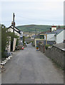
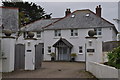
The property market in EX33 1NZ is characterised by high home ownership, with 79% of residents owning their homes. This suggests a market dominated by owner-occupied properties rather than rentals, reflecting the area’s appeal to long-term residents. The accommodation type is primarily houses, which aligns with the low population density and rural setting. This housing stock likely includes a range of traditional styles, from semi-detached to detached properties, catering to families and individuals seeking spacious living. Given the small size of the area, buyers should consider the limited availability of properties and the potential for competition among local residents. The focus on owner-occupation also implies a stable market with fewer speculative investments, making it a reliable choice for those prioritising security and long-term value.
House Prices in EX33 1NZ
Showing 5 properties
| Address | Type | Beds | Baths | Last Sale Price | Last Sale Date | |
|---|---|---|---|---|---|---|
| Off Shore, Beach Road, Croyde, EX33 1NZ | shop | - | - | - | - | |
| Sealawn, Croyde Bay Holidays, Beach Road, Croyde, EX33 1NZ | Flat | - | - | - | - | |
| Croyde Burrows Lodges, Ruda Holiday Park, Moor Lane, Croyde, EX33 1NZ | Flat | - | - | - | - | |
| Freshwell, Croyde Bay Holidays, Beach Road, Croyde, EX33 1NZ | hotel | - | - | - | - | |
| Security Hut, Moor Lane, Croyde, EX33 1NZ | Office | - | - | - | - |
Energy Efficiency in EX33 1NZ
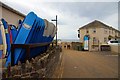
The lifestyle in EX33 1NZ is shaped by its proximity to practical amenities and natural surroundings. Within reach are three retail outlets in Braunton, including Spar, Co-op, and Tesco, providing everyday shopping convenience. The area’s access to Appledore and Instow ferry landings adds a maritime dimension, enabling trips to nearby coastal destinations. The presence of Royal Marines Base Chivenor Airport offers regional air connectivity, though it may not serve commercial passenger flights. These amenities contribute to a balanced lifestyle, combining rural tranquillity with essential services. The AONB designation ensures residents can enjoy scenic landscapes without compromising on practicality, making daily life both peaceful and functional.
Amenities
Schools
Residents of EX33 1NZ have access to a mix of primary and independent schools. The Georgeham Church of England (VC) Primary School and Georgeham Church of England Primary School serve the area, offering state-funded education with a religious affiliation. For those seeking alternative options, Horizons Small School provides independent education. The presence of both state and independent schools allows families to choose between public and private schooling. However, the data does not include Ofsted ratings or academic performance metrics. The proximity of these schools to the area suggests that families can rely on local educational facilities without needing to travel far. The variety of school types may appeal to parents with differing priorities, from community-focused state schools to smaller, specialised independent institutions.
| Rank | School | Type | Entry gender | Ages |
|---|
Explore more schools in this area
Go to Schools tabDemographics
The demographic profile of EX33 1NZ reflects a mature, stable community. With a median age of 47 and the majority of residents aged 30–64, the area is dominated by working-age adults. Home ownership is high, with 79% of households owning their properties, indicating a long-term commitment to the area. The accommodation is predominantly houses, suggesting a mix of family homes and single-occupancy properties. The predominant ethnic group is White, though no specific diversity statistics are provided. The population density of 81 people per square kilometre is relatively low, contributing to a spacious, less congested living environment. This demographic structure implies a community focused on stability, with fewer transient residents and a strong emphasis on local ties.
Household Size
Accommodation Type
Tenure
Ethnic Group
Religion
Household Composition
Age
Household Deprivation
NS-SEC
Explore more demographic insights in this area
Go to Demographics tabPlanning
Planning Constraints
- Flood RiskPremium
- Ramsar Wetland SitesPremium
- Area of Outstanding Natural BeautyPremium
- Protected Nature ReservePremium
- Protected WoodlandPremium