Area Overview for EX32 8EL
Photos of EX32 8EL
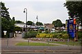
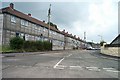
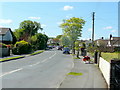
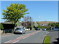
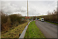
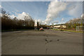
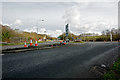
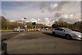
82 photos from this area
Area Information
Key information about the EX32 8EL including its size, population, and administrative classification.
- Area Type
- Postcode
- Area Size
- 1.4 hectares
- Population
- 1305
- Population Density
- 6378 people/km²
House Prices in EX32 8EL
56
Properties
£102,955
Average Sold Price
£41,000
Lowest Price
£176,000
Highest Price
Showing 56 properties
| Address | Type | Beds | Baths | Last Sale Price | Last Sale Date | |
|---|---|---|---|---|---|---|
| 30 Willshere Road, Barnstaple, EX32 8EL | house | - | - | £176,000 | Jun 2021 | |
| 19 Willshere Road, Barnstaple, EX32 8EL | house | - | - | £71,820 | Apr 2015 | |
| 41 Willshere Road, Barnstaple, EX32 8EL | house | - | - | £110,000 | Jun 2009 | |
| 18 Willshere Road, Barnstaple, EX32 8EL | Terraced | - | - | £133,000 | Mar 2008 | |
| 47 Willshere Road, Barnstaple, EX32 8EL | Semi-detached | 3 | 1 | £107,000 | Jun 2007 | |
| 34 Willshere Road, Barnstaple, EX32 8EL | house | - | - | £120,000 | Dec 2006 | |
| 45 Willshere Road, Barnstaple, EX32 8EL | house | - | - | £140,000 | Sep 2005 | |
| 52 Willshere Road, Barnstaple, EX32 8EL | Terraced | - | - | £70,775 | Jul 2004 | |
| 46 Willshere Road, Barnstaple, EX32 8EL | Terraced | - | - | £59,950 | Apr 2002 | |
| 43 Willshere Road, Barnstaple, EX32 8EL | Semi-detached | - | - | £41,000 | Apr 1999 |
Page 1 of 6
Energy Efficiency in EX32 8EL
Amenities
Schools
| Rank | School | Type | Entry gender | Ages |
|---|
Explore more schools in this area
Go to Schools tabDemographics
Household Size
One person
most common
Accommodation Type
Houses
most common
Tenure
38
majority
Ethnic Group
White
most common
Religion
N/A
most common
Household Composition
N/A
most common
Age
47
median
Adults (30-64 years)
most common
Household Deprivation
N/A
with no deprivation
NS-SEC
16
in Lower managerial occupations
Explore more demographic insights in this area
Go to Demographics tabPlanning
Planning Constraints
- Flood RiskPremium
- Ramsar Wetland SitesPremium
- Area of Outstanding Natural BeautyPremium
- Protected Nature ReservePremium
- Protected WoodlandPremium