Area Overview for EX31 4JB
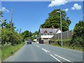
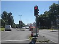
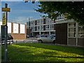
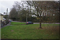
Photos of EX31 4JB


Area Information
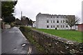
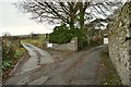
Living in EX31 4JB means being part of a tightly knit, compact residential cluster in England. The area covers just 8.0 hectares, housing 1,103 residents in a population density of 13,704 people per square kilometre. This density suggests a mix of closely spaced homes, likely contributing to a sense of community. The area’s demographics reveal a mature population, with a median age of 47 and the majority aged between 30 and 64. This age range indicates a stable, established community, possibly with a strong presence of families and professionals. While the area is small, its proximity to amenities like rail stations and retail outlets suggests a practical, accessible lifestyle. The high population density may mean limited space for expansion, but the compact nature of the area could foster a strong local identity. For buyers, this postcode offers a blend of residential simplicity and proximity to essential services, though the small size means properties are likely to be in close proximity to one another.
- Area Type
- Postcode
- Area Size
- 8.0 hectares
- Population
- 1103
- Population Density
- 1534 people/km²
The property market in EX31 4JB reflects a predominantly owner-occupied area, with 48% of residents owning their homes. However, the remaining 52% are likely to be renters, suggesting a mix of long-term residents and transient occupants. The accommodation type is exclusively houses, which is unusual for a small postcode area but may indicate a focus on family homes or larger properties. This composition implies limited availability of apartments or flats, which could be a consideration for buyers seeking different housing styles. The small size of the area—just 8.0 hectares—means the housing stock is constrained, with properties likely to be in close proximity to one another. Buyers should expect a competitive market for houses, with limited scope for expansion. The area’s proximity to rail stations and retail outlets may enhance its appeal, though the small size means the immediate surroundings are critical for additional options.
House Prices in EX31 4JB
Showing 9 properties
Energy Efficiency in EX31 4JB
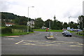
The lifestyle in EX31 4JB is shaped by its proximity to retail, rail, and travel infrastructure. Within practical reach are five retail outlets, including Co-op Barnstaple, Spar Churchill, and Spar, providing access to essential shopping and services. The two nearby rail stations—Barnstaple and Chapelton—offer regular connections to larger towns and cities, facilitating commuting or leisure travel. The Royal Marines Base Chivenor Airport adds another layer of connectivity, potentially appealing to those with travel or business needs. The compact nature of the area means amenities are closely clustered, fostering convenience but also limiting diversity. For residents, this setup offers a balance of local services and access to broader networks, though the small size means the character of the area is defined by its immediate surroundings. The mix of retail and transport options supports a practical, accessible lifestyle.
Amenities
Schools
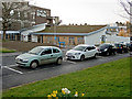
Residents of EX31 4JB have access to two schools: Pilton Infants’ School, a primary institution, and Pilton Infants’ Academy, an academy. Both are likely to serve the local community, offering education for younger children. The presence of a primary school and an academy suggests a range of educational approaches, though the data does not specify Ofsted ratings or academic performance. Families with young children may find these schools convenient, given their proximity to the area. The mix of school types could provide parents with options, though the lack of secondary schools in the immediate vicinity may require commuting. The absence of further educational institutions in the data highlights the need for nearby towns or cities for higher education. For homebuyers, the availability of these schools is a key consideration, particularly for those prioritising proximity to educational facilities.
| Rank | School | Type | Entry gender | Ages |
|---|
Explore more schools in this area
Go to Schools tabDemographics
The community in EX31 4JB is predominantly composed of adults aged 30–64, with a median age of 47. This suggests a population that is largely in their prime working years, potentially influencing local employment patterns and service demands. Home ownership stands at 48%, meaning nearly half of residents rent their homes. The accommodation type is primarily houses, indicating a lack of high-rise or apartment-style living. The predominant ethnic group is White, with no data provided on other demographics. The high population density of 13,704 people per square kilometre implies a compact, closely populated area, which could affect living conditions and community dynamics. While the data does not specify deprivation levels, the high density and mix of ownership and rental properties suggest a balance of stability and affordability. This profile may appeal to those seeking a settled, family-oriented environment with access to nearby amenities.
Household Size
Accommodation Type
Tenure
Ethnic Group
Religion
Household Composition
Age
Household Deprivation
NS-SEC
Explore more demographic insights in this area
Go to Demographics tabPlanning
Planning Constraints
- Flood RiskPremium
- Ramsar Wetland SitesPremium
- Area of Outstanding Natural BeautyPremium
- Protected Nature ReservePremium
- Protected WoodlandPremium